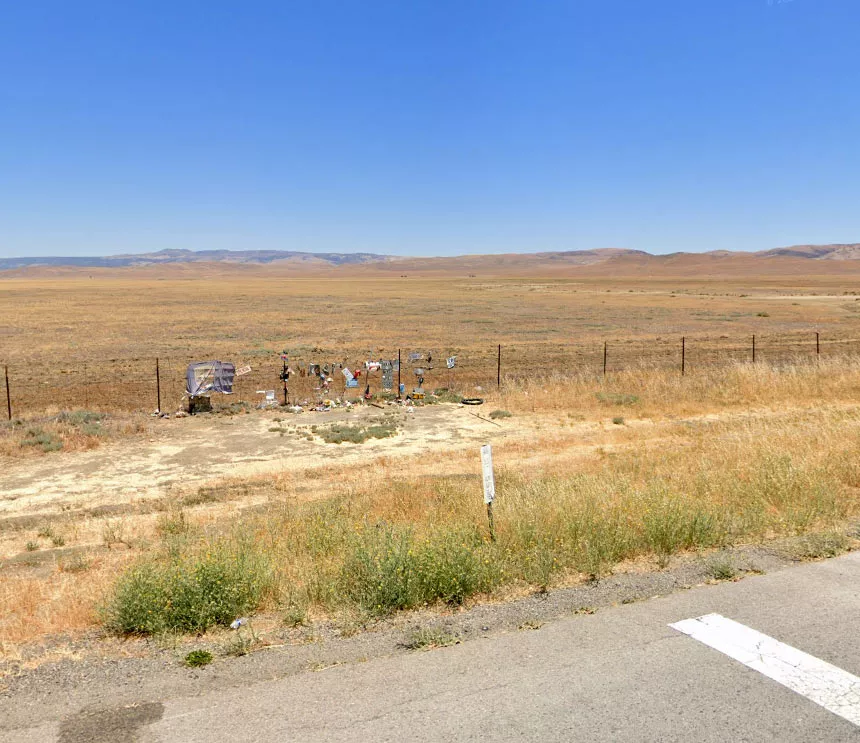
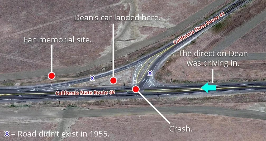
James Dean's crash site
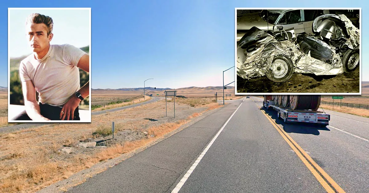
This is the location where James Dean died in a car accident.
It is situated on California State Route 46, near Shandon, California.
Google Maps shortcut
On September 30, 1955, the 24-year-old actor was fatally injured at this intersection after his Porsche 550 Spyder collided with an oncoming vehicle.
Dean suffered multiple internal injuries and a broken neck. Following the accident, he was rushed to a nearby hospital, where doctors pronounced him dead on arrival.
That Friday afternoon, Dean was speeding west along Route 466 toward Paso Robles, where he planned to stop for dinner before driving to Salinas, California.
Salinas was hosting a series of racing events that weekend, and Dean was scheduled to take part in one of them.
However, as he was approaching this intersection, a motorist driving in the opposite direction cut across his lane to turn left. When the other car, a black 1950 Ford Tudor, crossed into Dean's path, the "Rebel Without a Cause" star quickly realized that he was in imminent danger.
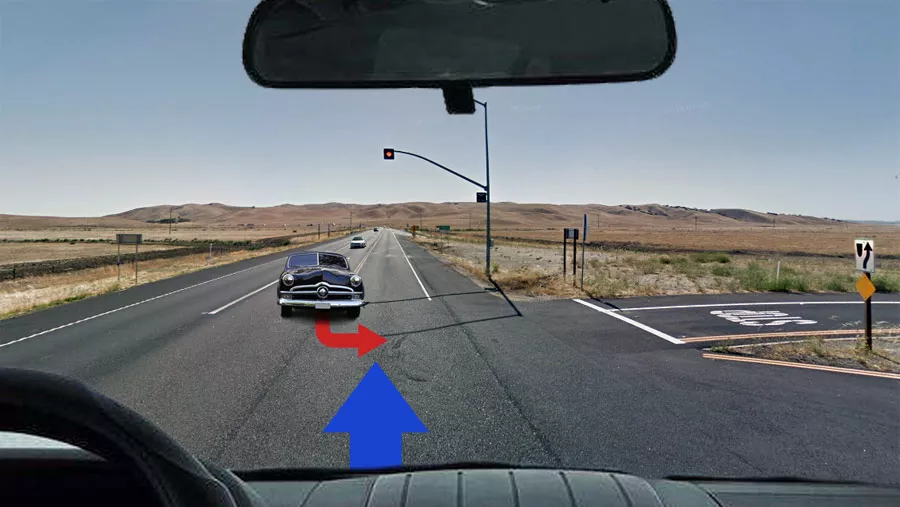
Although he attempted to dodge the vehicle, the speed at which he was driving left him with little time to react.
Police reports state that Dean was driving approximately 55 mph (88 km/h) at the time of the impact. The two vehicles collided head-on, sending his Porsche Spyder tumbling across the road until it landed beside a fence at the side of the interstate.
Witnesses said that the car "cartwheeled" as it smashed into the ground multiple times.
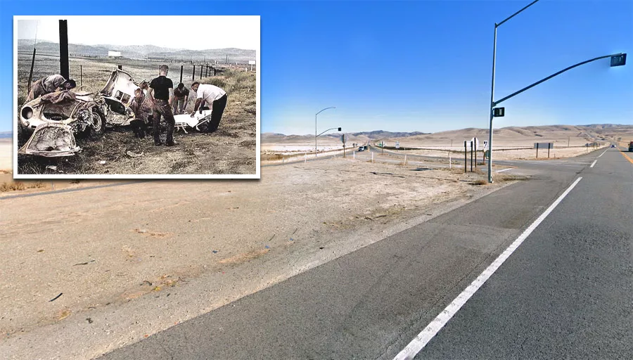
In the blink of an eye, one of Hollywood's most promising young actors was dead.
Location
The address and GPS coordinates for the site are as follows:
Address
California State Route 46, Shandon, CA 93461, USA
GPS Coordinates
35.734568, -120.284735
35°44'04.44"N 120°17'05.05"W
Get Directions
Open this location in your preferred maps app:
Area Information
📍 The site is about 80 miles southwest of Fresno, California. It is situated at the intersection of California State Route 46 and State Route 41, roughly one mile north of the Jack Ranch Cafe.
Map Viewer
There is more than one location associated with this entry. To view these places on one map, you can use the following feature:
This location belongs to the following categories:
CelebritiesClosest Locations
Other locations that are relatively close to this address:
The location where "Kai the Hatchet-Wielding Hitchhiker" was interviewed
Roughly 94 miles away.
Interview Location in Fresno, California
The alley where Candice Welch was found
Roughly 95 miles away.
Crime Location in Bakersfield, California
The house where child actress Judith Barsi was murdered
Roughly 176 miles away.
Crime Location in Los Angeles, California