The location where Bonnie and Clyde were killed

This is the location where Bonnie and Clyde were shot dead in an ambush.
It is located on Par Road 300 in Gibsland, Louisiana. The exact coordinates are available in the "Address" section below.
Barrow Gang
Bonnie Elizabeth Parker and Clyde Chestnut Barrow were armed robbers who targeted stores, funeral homes, and banks between 1932 and 1934. They are also believed to have murdered at least 13 people, most of whom were police officers.
The couple was part of the Barrow Gang, a notorious band of outlaws that carried out a string of violent crimes across several states.
The fact that Bonnie and Clyde were "lovers in crime" captivated the public and garnered significant media attention.
Working-class people, in particular, felt sympathetic to the couple, as the United States was in the midst of the Great Depression. In their eyes, they were folk heroes who targeted the same financial institutions that had caused the Wall Street Crash of 1929.
However, public perception of Bonnie and Clyde turned negative in April 1934 after the Barrow Gang shot and killed a widowed constable named William "Cal" Campbell in Commerce, Oklahoma.
By that point, they were already the subject of a nationwide manhunt, as they had previously broken their associates out of the Eastham prison farm in Texas just four months prior. This incident caused great embarrassment for the authorities, who soon hired former Texas Ranger Captain Frank Hamer to hunt the gang down.
Investigation
Hamer spent months following the couple and searching for patterns in their movements.
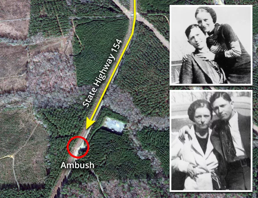
In May 1934, the lawman received information that they were going to meet at a rendezvous point near this rural highway in Bienville Parish. The vital tip reportedly came from Ivy Methvin, who was the father of Barrow Gang member Henry Methvin.
Methvin had agreed to cooperate with the local sheriff's office to spare his son from the death penalty.
Ambush
On May 22, 1934, Hamer and five other officers set up an ambush at this location on Louisiana State Highway 154. To catch the gang's attention and slow them down, they parked Ivy Methvin's truck on the side of the road.
Following a night of hiding in the trees, the officers grew weary and began making plans to call off the operation. However, at approximately 9:15 a.m., they heard the sound of a vehicle speeding in the distance.
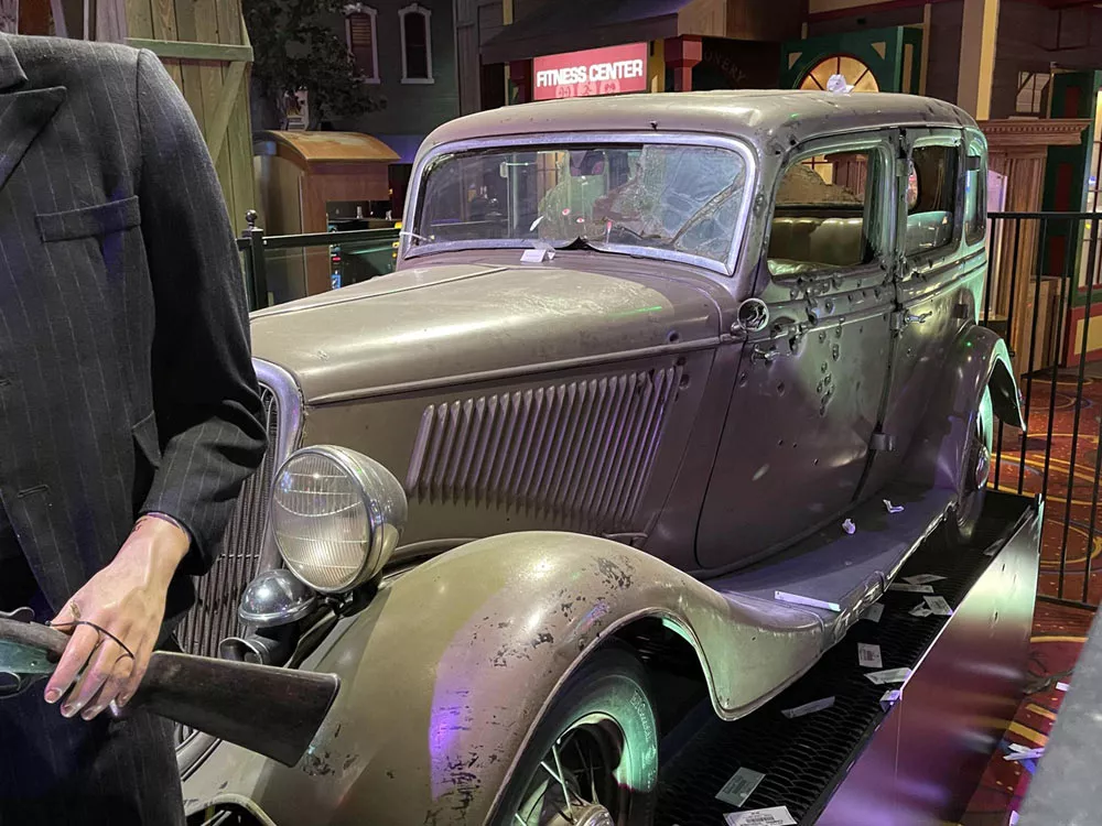
After taking a quick look, they spotted a 1934 Ford Deluxe V-8, which was known to be Clyde's preferred make and model.
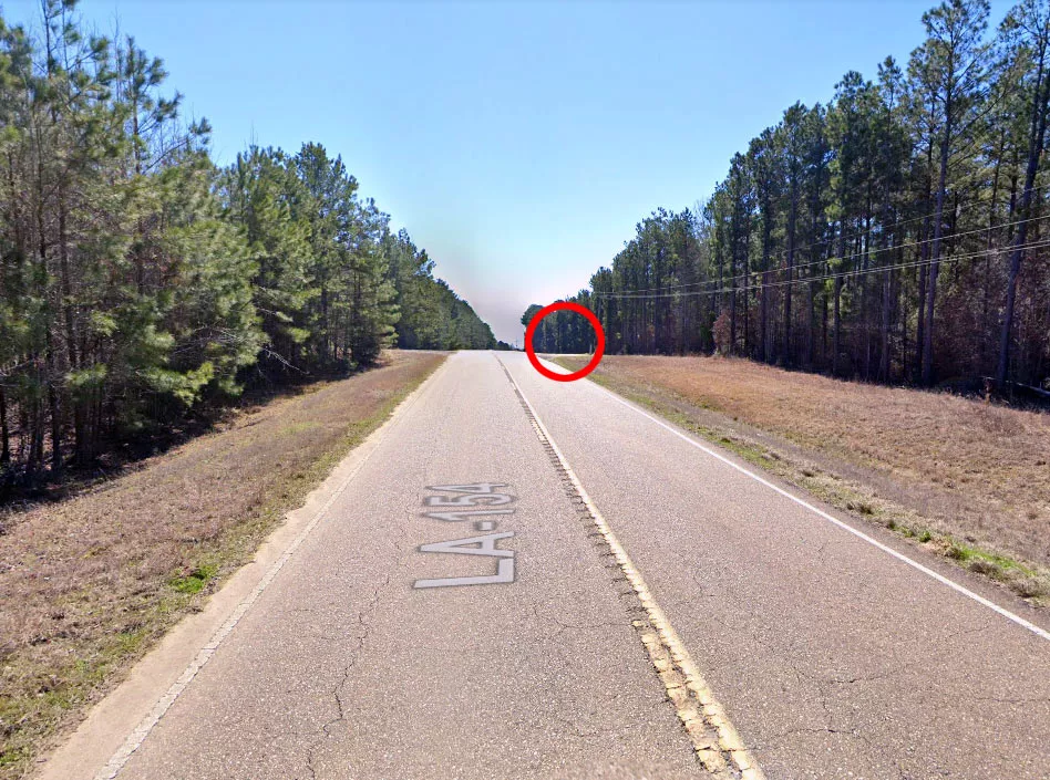
The officers' decoy was a success, as Clyde recognized Ivy Methvin's truck and started slowing down.
Moments later, Hamer and his team opened fire with their automatic rifles. However, they wasted most of their rifle ammunition before the car was close enough. As a result, they had to switch to their shotguns.
When their shotguns emptied, the officers took out their pistols and continued firing.
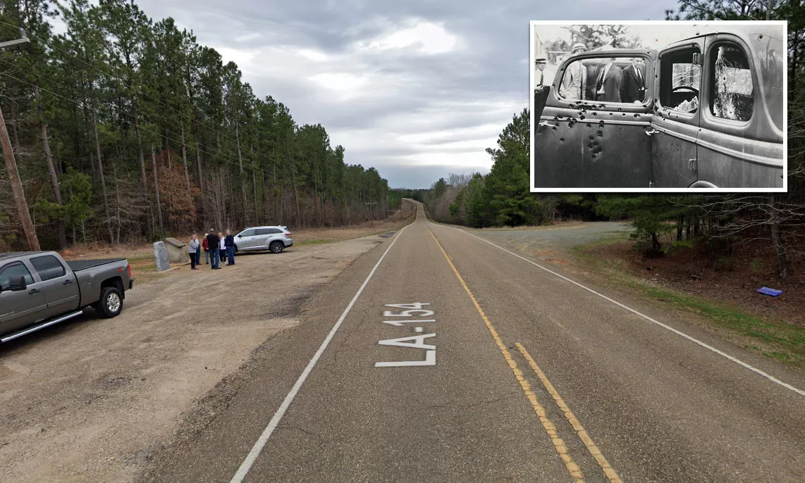
Bonnie and Clyde were both shot more than a dozen times and killed almost instantly. By the time the last gun was lowered, their vehicle had more than 100 bullet holes.
The couple's dramatic deaths at the hands of law enforcement cemented their legacy in American culture. So much so that they are often referenced whenever a man and a woman commit crimes together.
Google Maps shortcut
To this day, they continue to influence films, music, theater, and literature.
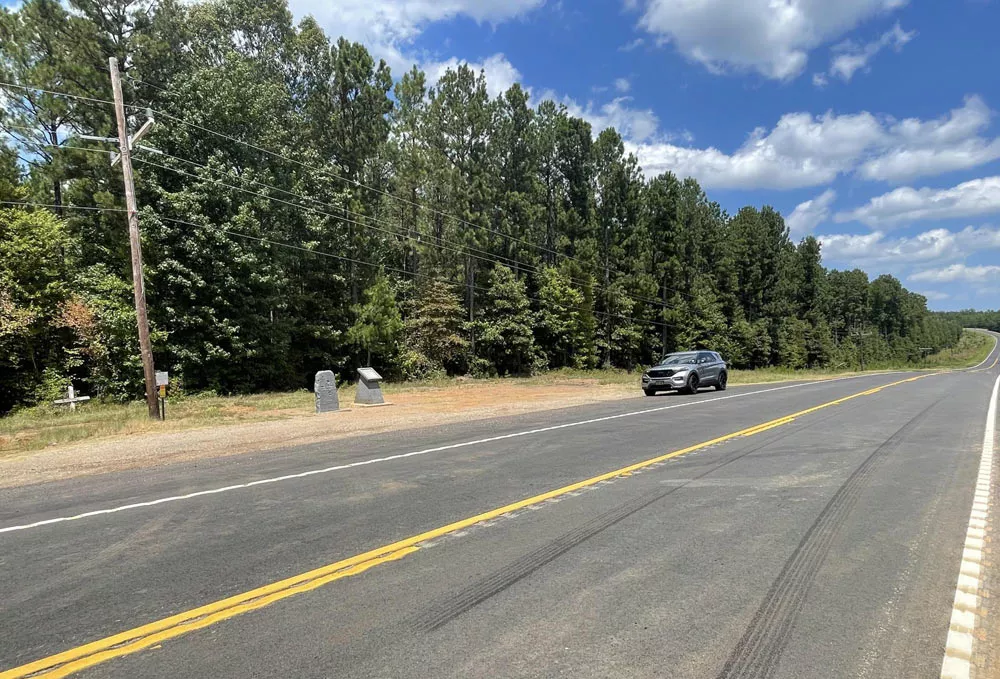
Monuments
Two monuments exist at the ambush site. The one on the left has been shot multiple times and heavily graffitied by couples.
It reads:
"This site. May 23, 1934. Clyde Barrow and Bonnie Parker were killed by law enforcement officers."
The marker on the right pays tribute to the officers who carried out the ambush.
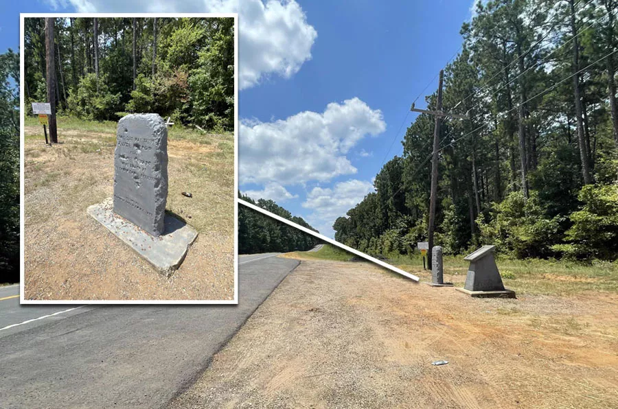
Bienville Parish has also erected a warning sign to deter vandals:
"These monuments were placed here to mark a Bienville Parish time in history. Please do not deface these monuments by marking them or chipping away at them. Just enjoy their meaning. They are under video surveillance."
Location
The address and GPS coordinates for the site are as follows:
Address
Par Road 300, Gibsland, LA 71028, USA
GPS Coordinates
32.441176, -93.092591
32°26'28.23"N 93°05'33.33"W
Get Directions
Open this location in your preferred maps app:
Area Information
Gibsland is a town in Bienville Parish, which is in the north of Louisiana. It lies about 30 miles east of Shreveport.
📍 The site is situated roughly 8 miles south of Gibsland. It is just north of the intersection between Louisiana State Highway 154 and Louisiana State Highway 516.
Map Viewer
There is more than one location associated with this entry. To view these places on one map, you can use the following feature:
This location belongs to the following categories:
Notorious Figures