The site where Laura Ann Aime was found
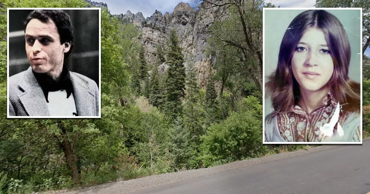
This is the site where serial killer Ted Bundy dumped the remains of Laura Ann Aime.
It is situated off Utah State Route 92 in American Fork Canyon, Utah.
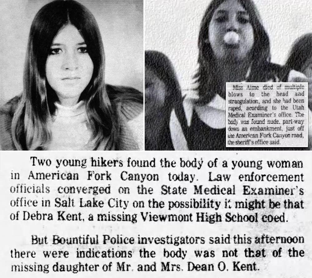
Aime was a 17-year-old who disappeared after leaving a café in Lehi on the night of October 31, 1974.
Approximately one month later, two university students discovered her remains at the bottom of this creek bank.
Discovery
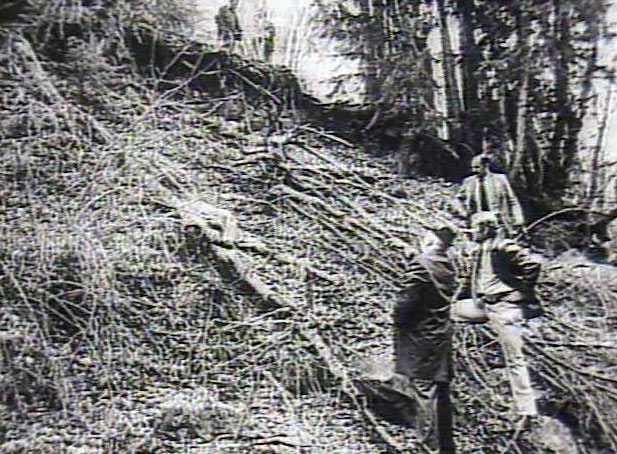
On the morning of November 27, two students were searching for fossils in the area when one of them noticed Aime's body on the bank.
She was lying facedown, about 10 meters from the highway. A nylon stocking had been tightly wrapped around her neck.
Fearing that the perpetrator might still be in the area, the pair left the scene and drove to the nearest ranger station.
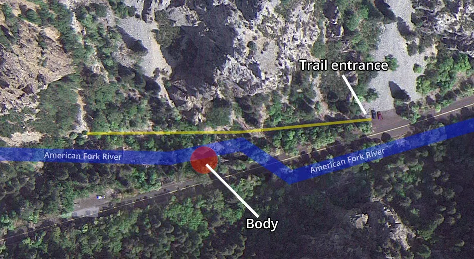
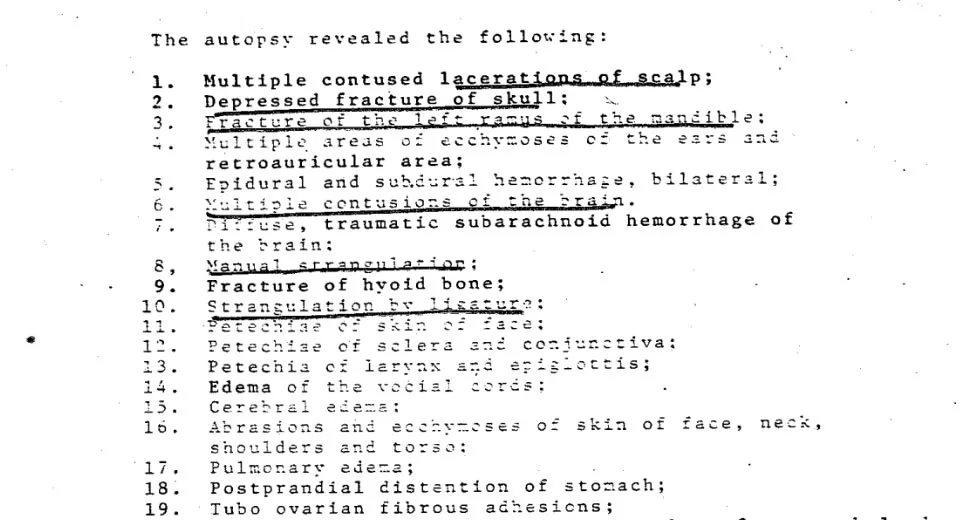
Investigators determined that Aime's killer had struck her over the head, raped her, and then strangled her. Following the murder, the offender dumped her body down the side of this embankment.
Bundy
Although Bundy did not confess to Aime's murder, the transcript from his death row confession shows he made no effort to deny it.
Instead, he suggested that they could talk about it at a later stage.

The crime bore all the hallmarks of one of his murders, including the victim profile.
Additionally, tire track patterns in the immediate area matched his Volkswagen Bug.
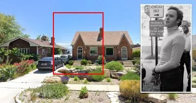
At the time of Aime's murder, Bundy was living in Salt Lake City and actively targeting women in the area.
Consequently, the authorities were certain of his involvement.

Disappearance
There are conflicting accounts of Aime's movements on the night of October 31, 1974. Some sources say she began the evening at a house party in Orem, while others make no mention of such a gathering.
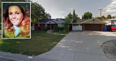
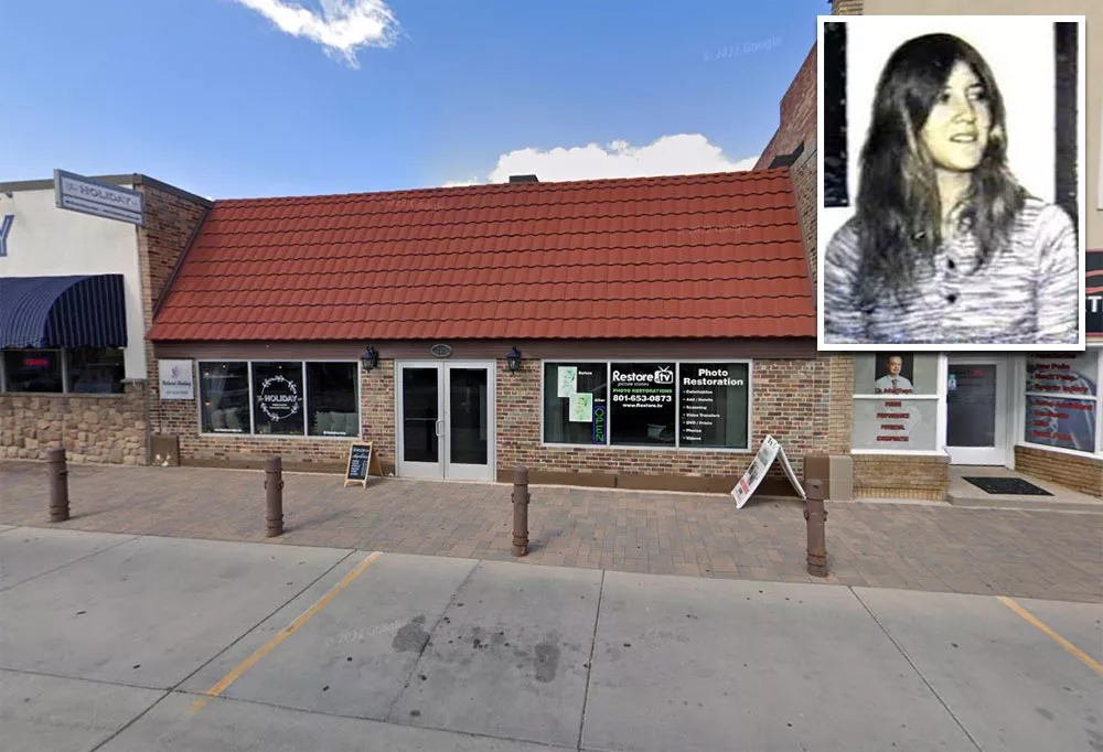
Most sources agree, however, that she spent time at the Knotty Pine Café at 130 West Main Street in Lehi.
Google Maps shortcut
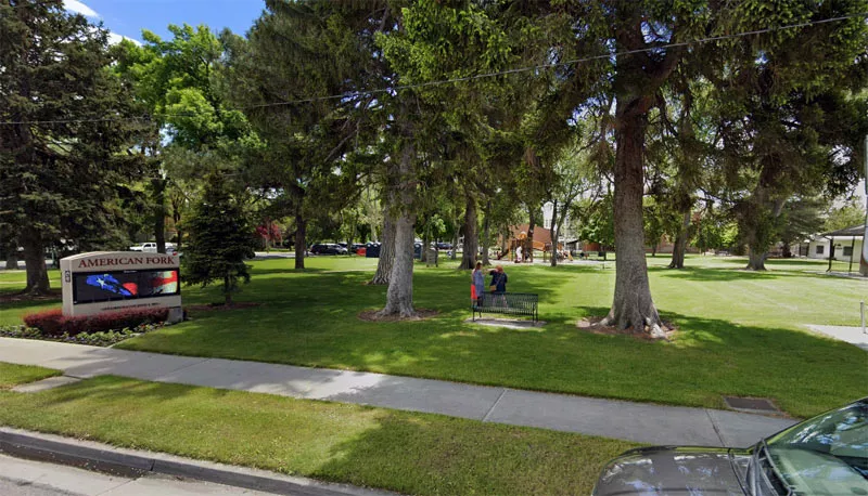
Aime did not stay at the café for long, as she was reportedly eager to hitchhike to Robinson Park in American Fork.
One witness claimed they saw Aime at the park around midnight. If correct, this was the last time she was seen alive.
Google Maps shortcut
That night, Aime appeared to be traveling between multiple locations. The most likely explanation is that she was searching for social gatherings. Because it was Halloween, groups of teenagers were lsocializing in different areas.
Robinson Park is 3.2 miles away from the Knotty Pine Café. If Aime walked to the park, it would have taken her roughly an hour.
Given the distance, it is plausible she tried to hitchhike back to Lehi after visiting the park. By that time, it was getting late, and the temperature had dipped to 45°F (7.2°C).
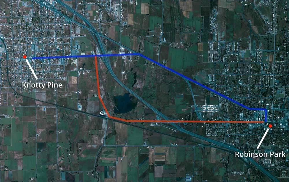
The blue route shown on the map above is slightly shorter and had more traffic, which would have been advantageous if her intention was to hitchhike.
During the 1970s, the land between Lehi and American Fork was not as developed as it is today.
2026 update
Although authorities believed Bundy was responsible for Aime's murder, they declined to close the case because he failed to provide corroborating details.
In 2023, the Utah state crime lab acquired new technology that can extract DNA from degraded samples. Forensic investigators were able to analyze semen swabs taken from Aime's body and submit them to the national CODIS database.
On April 1, 2026, the Utah County Sheriff's Office announced that advancements in DNA technology "confirmed irrefutably" the presence of Bundy's DNA on Aime's body.
Location
The address and GPS coordinates for the site are as follows:
Address
Utah State Route 92, Salt Lake City, UT 84004, USA
GPS Coordinates
40.444871, -111.698120
40°26'41.54"N 111°41'53.23"W
Get Directions
Open this location in your preferred maps app:
Area Information
📍 The site is half a mile east of the Timpanogos Cave visitor center.
Map Viewer
There is more than one location associated with this entry. To view these places on one map, you can use the following feature:
Closest Locations
Other locations that are relatively close to this address:
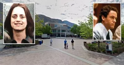
Crime Location · Provo, Utah
The campus where Ted Bundy abducted Susan Curtis
Roughly 17 miles away.
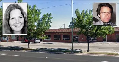
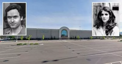
Crime Location · Midvale, Utah
The pizza parlor where Melissa Smith was last seen
Roughly 19 miles away.
Crime Location · Murray, Utah
The mall where Ted Bundy kidnapped Carol DaRonch
Roughly 20 miles away.