The location where the "Bliss" wallpaper for Windows XP was taken
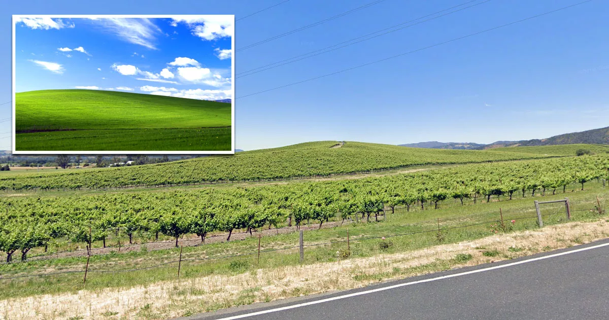
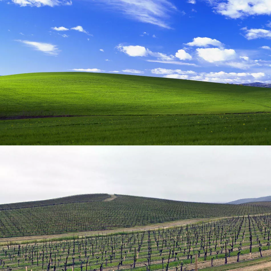
This is the location where the photograph for the iconic "Bliss" Windows XP wallpaper was taken.
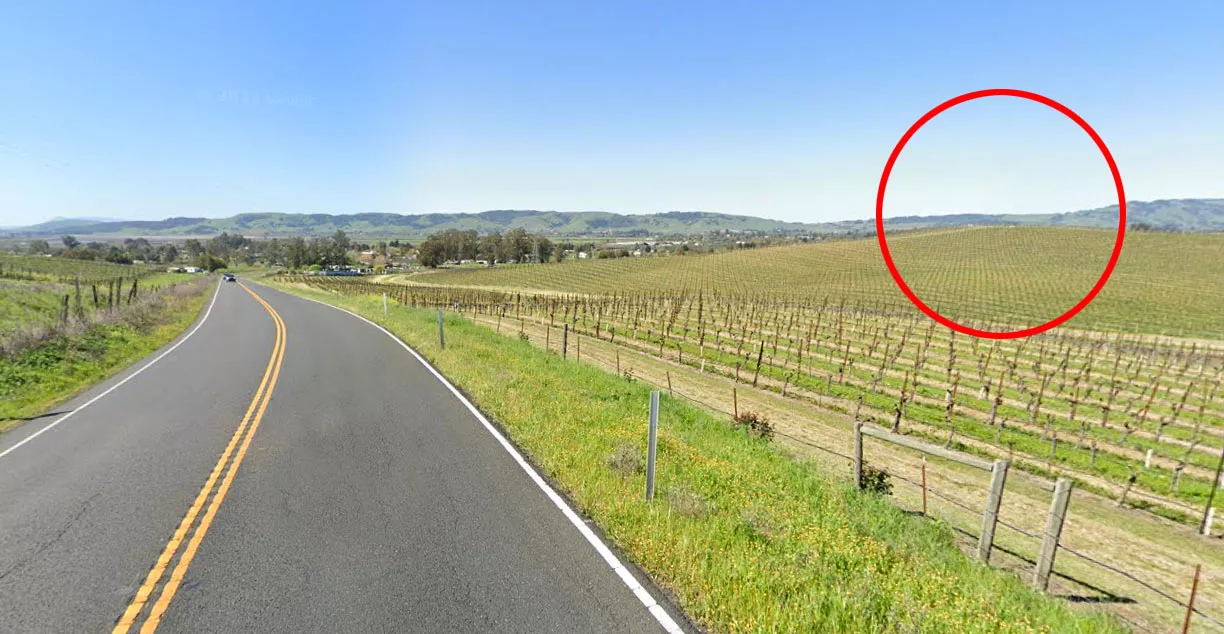
It is situated on Highway 121 in Sonoma County, California, roughly 1.5 miles east of a small community called Schellville.
To find the exact location, you can use the coordinates that we have listed in the directions section below.
A man named Charles O'Rear snapped the photograph in January 1996 while he was driving westward along Highway 121 toward his girlfriend's house.
That day, a storm had passed over northern California. Knowing that the weather conditions might provide him with a good photo opportunity, O'Rear took his camera with him and remained on the lookout for the perfect shot.
When he reached this section of the highway near Schellville, he noticed the bright green hill on his right and decided to pull over.

As he jumped out of his vehicle and grabbed his tripod, he had no way of knowing that he was about to take one of the most recognizable images in human history. Nor did the passersby who saw him standing on the side of the road.
Initially, O'Rear made it available online as a stock photo. However, in 2000, Microsoft contacted him and offered to buy the rights to his image for a six-figure sum.
The cost of buying the photo was so high that couriers refused to deliver the original film due to insurance reasons. Consequently, O'Rear had to fly to Microsoft's headquarters and hand-deliver it himself.
After buying the image, Microsoft named it "Bliss" and used it as the default wallpaper for Windows XP, a critically acclaimed operating system that sold 17 million copies in the first two months after its release.
Between 2001 and 2006, more than 400 million copies of Windows XP were sold.
This means that people all over the world have viewed O'Rear's photo billions of times.
Location
The address and GPS coordinates for the site are as follows:
Address
Highway 121, Sonoma, CA 95476, USA
GPS Coordinates
38.248484, -122.410783
38°14'54.54"N 122°24'38.82"W
Get Directions
Open this location in your preferred maps app:
Area Information
Sonoma County lies between Marin County and Mendocino County in northern California.
📍 The hill in "Bliss" is on the northern side of the highway, about 250 yards east of the entrance to Ramal Road. The closest address is 3150 Highway 121, Sonoma. It is roughly 19 miles southeast of Santa Rosa.
Private Property Warning
This is private property, not a public space. Please respect the owners and do not enter without permission. Entry without permission is trespassing and may be met with legal or other serious consequences.
Comment: The hill is not public property.
Closest Locations
Other locations that are relatively close to this address:
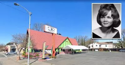
Place of Interest · Napa, California
The phone where the Zodiac Killer reported the Lake Berryessa attack
Roughly 9 miles away.
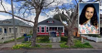
Crime Location · Petaluma, California
The house where Polly Klaas was kidnapped
Roughly 15 miles away.
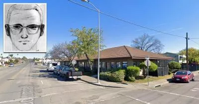
Place of Interest · Vallejo, California
The location where the Zodiac Killer reported the Blue Rock Springs shooting
Roughly 17 miles away.