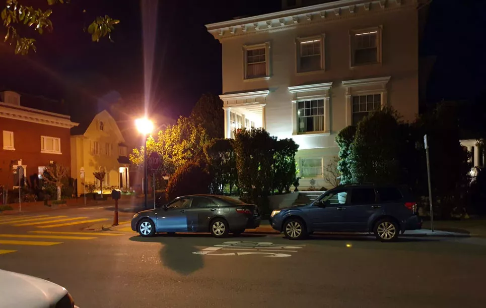
The street where Paul Stine was murdered
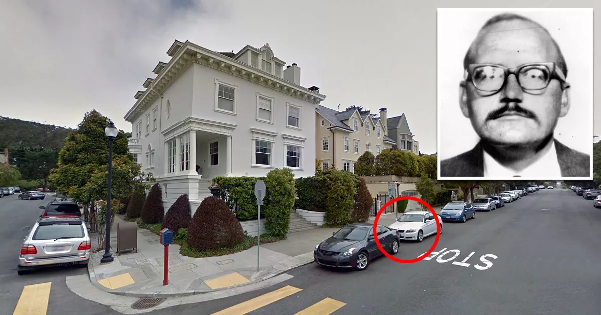
This is the location where the Zodiac Killer murdered Paul Stine.
It is situated outside 3898 Washington Street in San Francisco, California.
Stine was the Zodiac's last confirmed victim.

On the night of October 11, 1969, the 29-year-old cab driver picked up a man near Union Square in downtown San Francisco.
According to Stine's logbook, the passenger originally asked to be driven to the corner of Washington Street and Maple Street. However, for unknown reasons, Stine drove about 350 feet past the location before stopping near Cherry Street.
The discrepancy between the log entry and the final location remains a mystery. It is possible that the killer saw a potential witness at the original destination and directed Stine to drive further west.
When the cab pulled over to the side of Washington Street, the Zodiac Killer held up a 9mm handgun and shot Stine in the back of the head, killing him almost immediately.
After taking the victim's wallet and car keys, he ripped off a piece of Stine's bloodstained shirt so that he could later mail it to a local newspaper and claim responsibility for the crime.

While all of this was unfolding, three teenagers in a house across the street spotted the "robbery" and called 911.
They reported that the killer, who had a crew-cut hairstyle, turned the corner and walked north along Cherry Street, toward the park at the Presidio.

Shortly afterward, two patrol officers who were responding to the "robbery" noticed a white male with a similar haircut on Jackson Street, which is just one block north of the crime scene. The man was walking eastward while they were driving west.

Frustratingly, there was a mix-up during the dispatch call, and the suspect was originally described as being a Black male.
As a result, the man with the crew-cut hairstyle was allowed to continue walking.
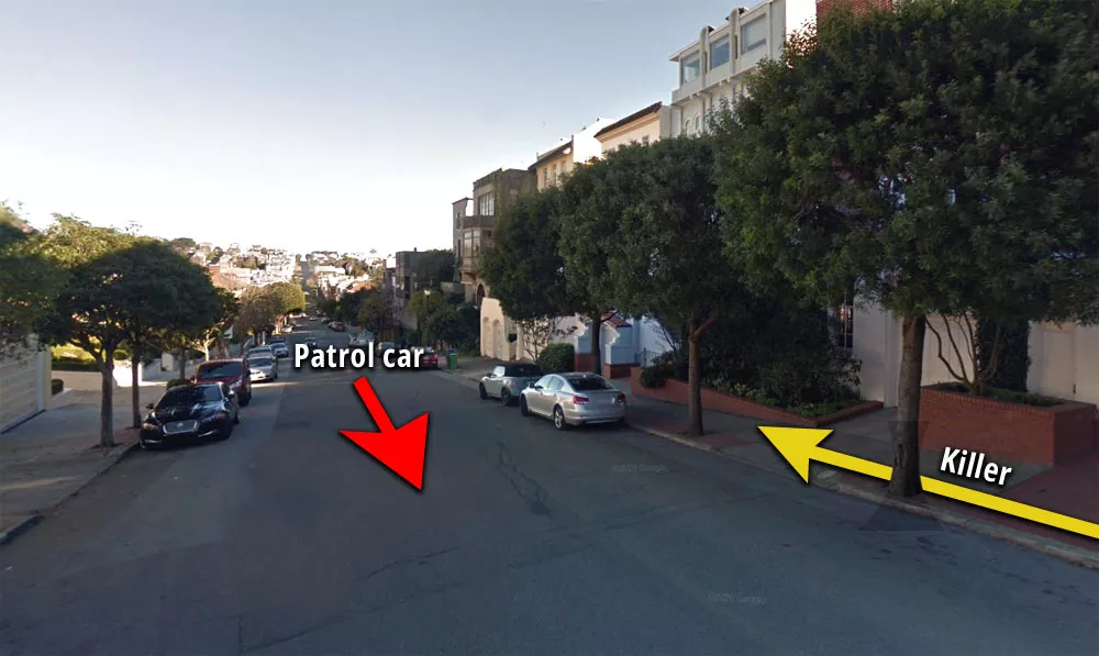
The killer may have been caught if the original description hadn't misrepresented his skin tone. When he saw the patrol car approaching in the distance, he must have thought that he had finally reached the end of the line.
Unfortunately, he got extremely lucky due to the dispatcher's mix-up.
This close call may have convinced the killer to "hang up his boots," so to speak. Following Stine's murder, it appears as though the Zodiac never killed again.
Although detectives initially believed that the shooting was a robbery gone wrong, that notion was shattered when the killer sent a piece of Stine's shirt to a local newspaper, along with a letter that mocked the police's ineptitude.
Location
The address and GPS coordinates for the street are as follows:
Address
3898 Washington Street, San Francisco, CA 94118, USA
GPS Coordinates
37.788793, -122.456972
37°47'19.65"N 122°27'25.10"W
Get Directions
Open this location in your preferred maps app:
Area Information
📍 The corner of Washington Street and Cherry Street is about 240 yards east of Arguello Boulevard. It is a short distance away from the Presidio.
This location belongs to the following categories:
Crime Scenes Serial Killers Unsolved Cases Zodiac Killer LocationsClosest Locations
Other locations that are relatively close to this address:
The location where the Zodiac Killer reported the Blue Rock Springs shooting
Roughly 31 miles away.
Place of Interest in Vallejo, California
The IHOP where Darlene Ferrin worked
Roughly 31 miles away.
Place of Interest in Vallejo, California