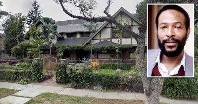
Michael Jackson's Thriller house
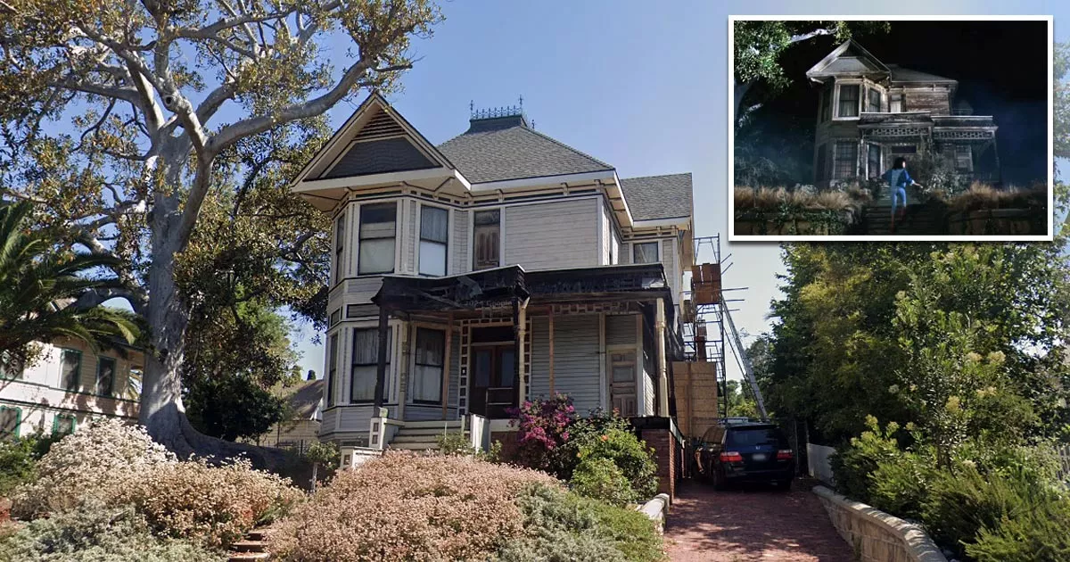
This is the house that was featured in the iconic music video for Michael Jackson's song "Thriller".
It is located at 1345 Carroll Avenue in Los Angeles, California.
Released on December 2, 1983, the video is a short story about a young couple who are watching a horror film at a movie theater.

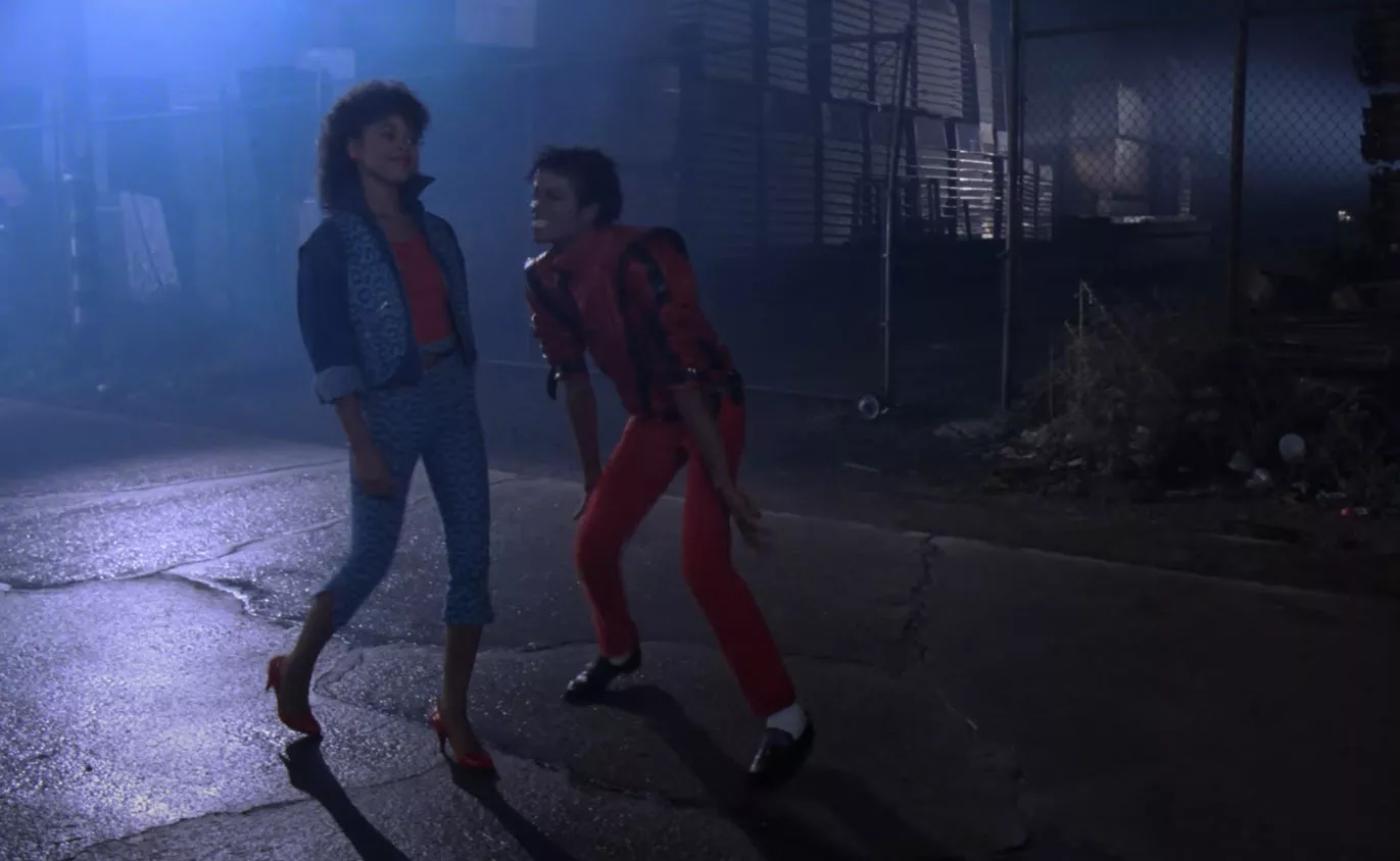
During the movie, Jackson's girlfriend becomes so scared that she decides to leave. Jackson eventually follows her out of the theater, and they begin to walk home together through the dark, empty streets.
Shortly after, a group of zombies emerges from a nearby graveyard and surrounds them.
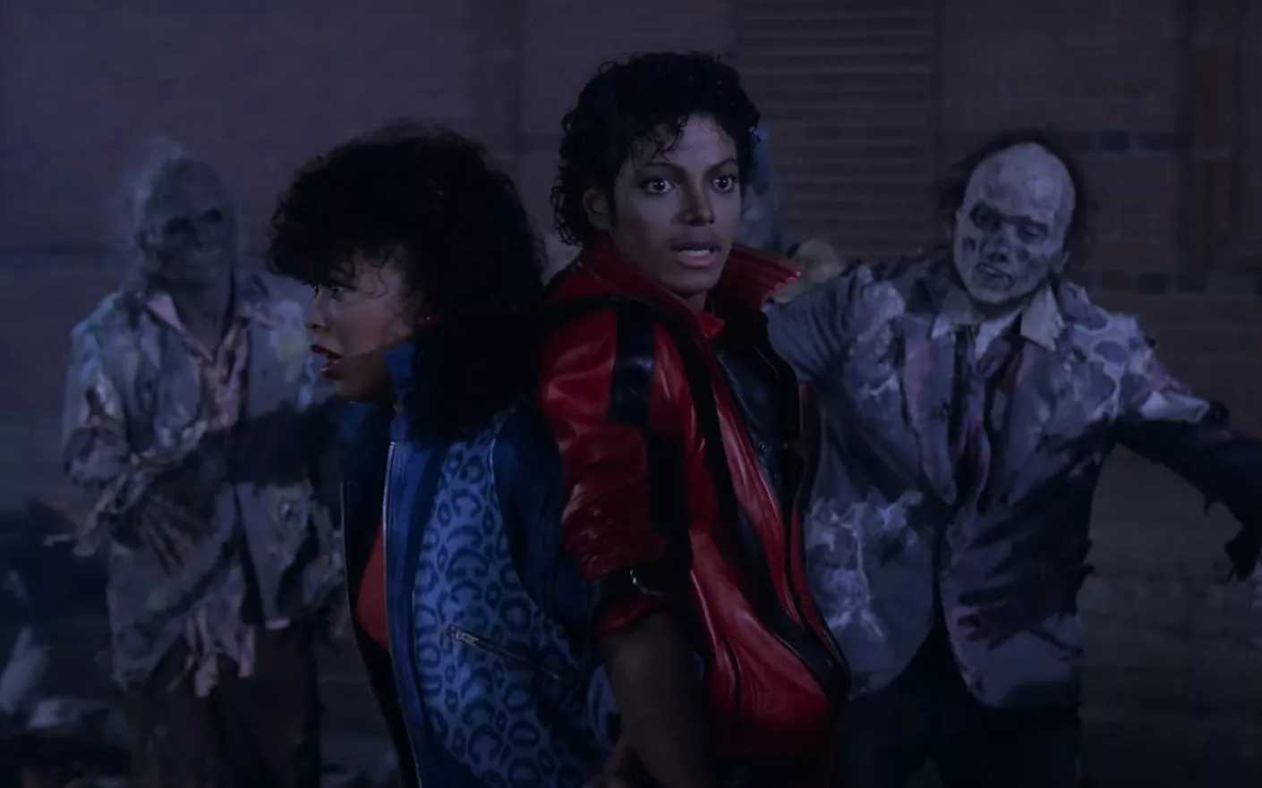
As the horde is slowly closing in, Jackson's girlfriend looks around at him and is horrified to learn that he has turned into a zombie.

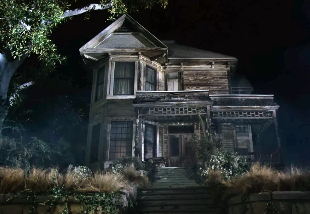
Jackson joins the horde in a choreographed dance while his girlfriend runs toward this abandoned house.
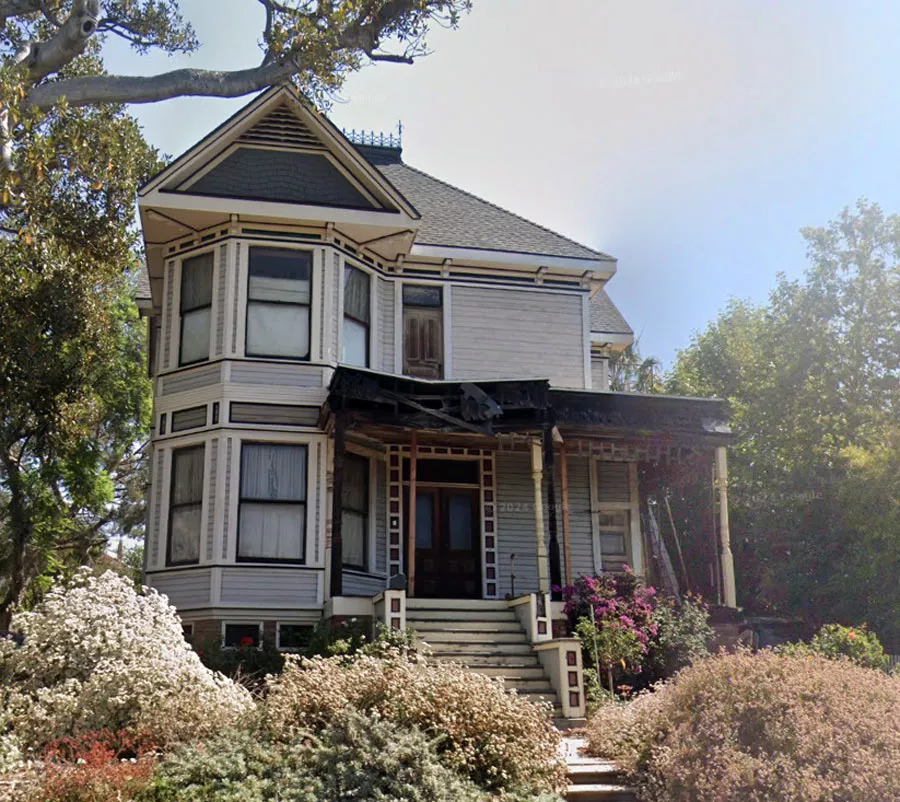
Although she manages to get inside and barricade herself in a room, the zombies begin to smash their way through the floorboards and windows.
When her boyfriend breaks down the door and grabs her shoulder, she wakes up screaming on his couch and realizes that it was just a nightmare. After Jackson confusedly asks, "What's the problem?" and offers to bring her home, the couple embrace each other and turn to leave.
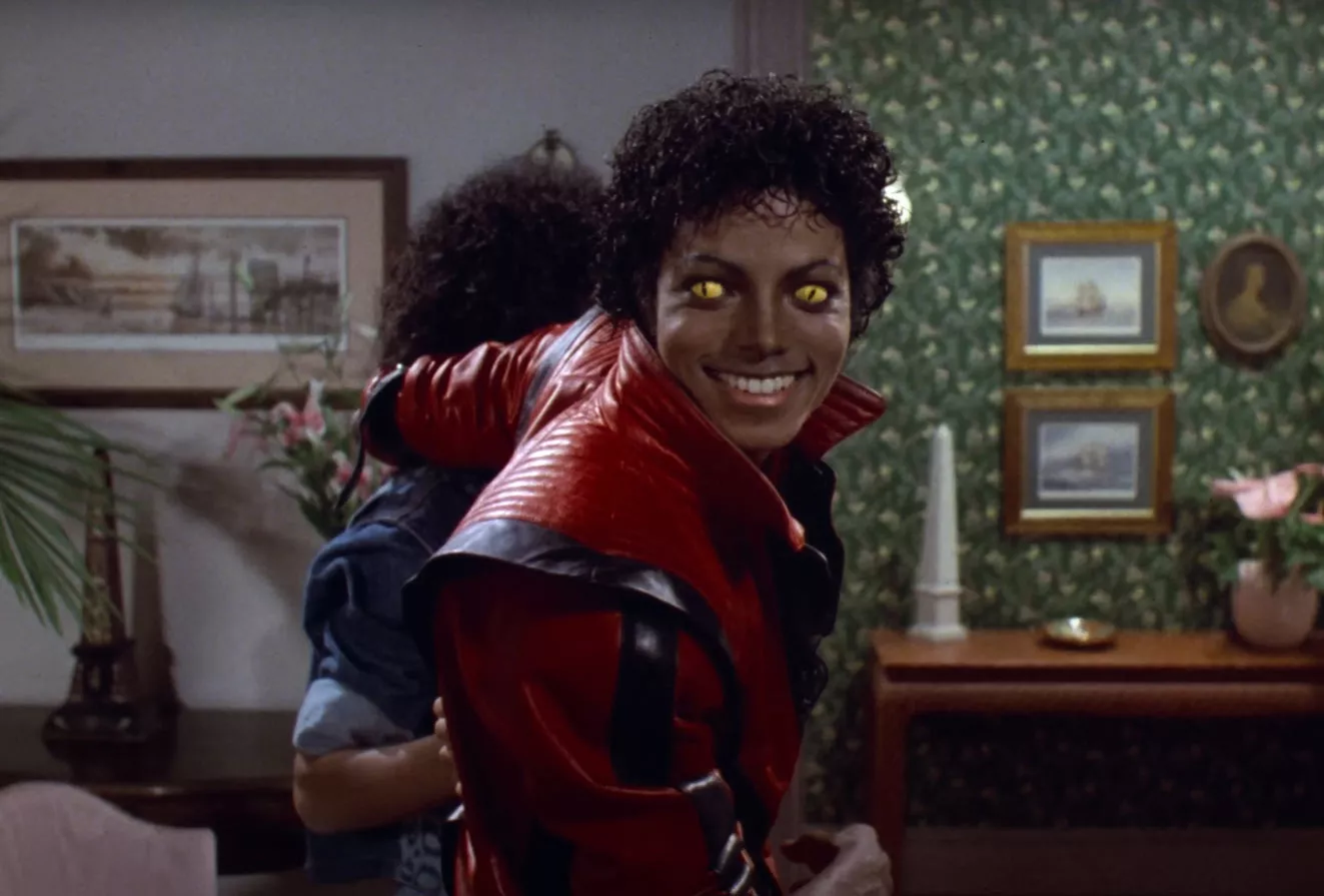
However, before they go, Jackson flashes a sinister grin at the camera while his eyes glow bright yellow.
Address
The address and GPS coordinates for the house are as follows:
Address
1345 Carroll Ave, Los Angeles, CA 90026, USA
GPS Coordinates
34.069687, -118.254499
34°04'10.87"N 118°15'16.20"W
Get Directions
Open this location in your preferred maps app:
Area Information
It is situated in the Angelino Heights neighborhood of Los Angeles.
Private Property Warning
This is private property, not a public space. Please respect the owners and do not enter without permission. Entry without permission is trespassing and may be met with legal or other serious consequences.
Closest Locations
Other locations that are relatively close to this address:
Crime Location · Los Angeles, California
The sidewalk where Mark Diggs was murdered
Roughly 3 miles away.

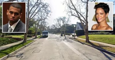
Assault Location · Los Angeles, California
The street where Chris Brown assaulted Rihanna
Roughly 6 miles away.