The location where "Prepare to Meet Thy God" was taken
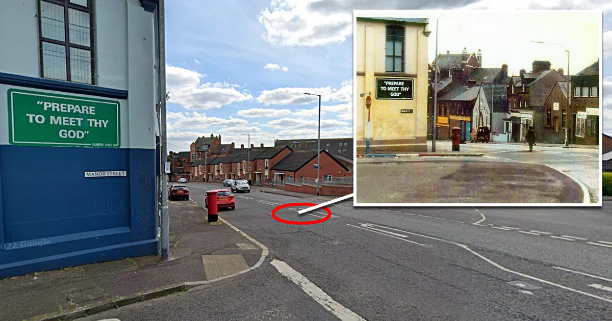
This is the location where the "Prepare to Meet Thy God" photograph was taken.
It is situated on the northeastern corner of Oldpark Road and Manor Street in Belfast, Northern Ireland.
The photograph shows a lone British Army bomb disposal expert walking toward a Volkswagen campervan that is suspected of being fitted with an improvised explosive device. A sign on his left reads, "Prepare to Meet Thy God", which is a quote from the Bible verse Amos 4:12. A remotely controlled Wheelbarrow robot has already removed the van's back door.
The composition, the foreboding quote, the deserted street, and the lone EOD operator combine to such great effect that it is frequently mentioned whenever social media users discuss their favorite photographs.
A member of the Belfast EOD team snapped the image in 1987 as part of their daily work diary.
The man walking toward the van was an ammunition technical officer (ATO) named Chris Hodder. The photographer was the driver of a Humber Pig armored truck, which was parked at the junction between Oldpark Road and Manor Street.
Fortunately, the suspected bomb turned out to be a hoax. That day, the Provisional Irish Republican Army (IRA) dumped a number of vehicles in various locations around Belfast and anonymously called them in. By doing this, they were able to stretch the security services and grind the city to a halt.
The van on Oldpark Road was the sixth hoax call that day.
Although Hodder said that he instructed the PIG driver to take the photograph "as a joke", it is likely that the quote spooked him to some degree. By that point in The Troubles, IRA devices had already killed more than twenty EOD experts.
Location
The address and GPS coordinates for the junction are as follows:
Address
Oldpark Road, Belfast, Antrim, BT14 6FR, Northern Ireland
GPS Coordinates
54.611106, -5.947812
54°36'39.98"N 5°56'52.12"W
Get Directions
Open this location in your preferred maps app:
Closest Locations
Other locations that are relatively close to this address:
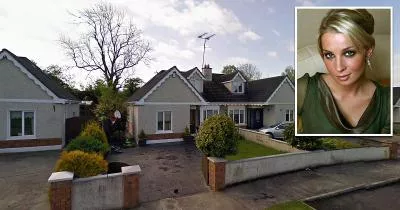
Place of Interest · Kilmessan, Meath, Ireland
The house where Katy French collapsed
Roughly 158KM away.
Fire Location · Artane, Dublin, Ireland
The location where the Stardust fire occurred
Roughly 172KM away.
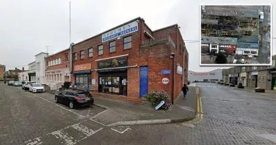
Crime Location · Corduff, Dublin, Ireland
The pub where Bernard "Verb" Sugg was killed
Roughly 172KM away.
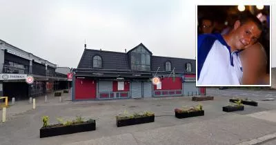
Crime Location · Whitehall, Dublin, Ireland
The location where the Regency Hotel shooting occurred
Roughly 174KM away.
Crime Location · Finglas, Dublin, Ireland
The house where Marlo Hyland was killed
Roughly 174KM away.