Michael Jackson's Thriller zombie dance location
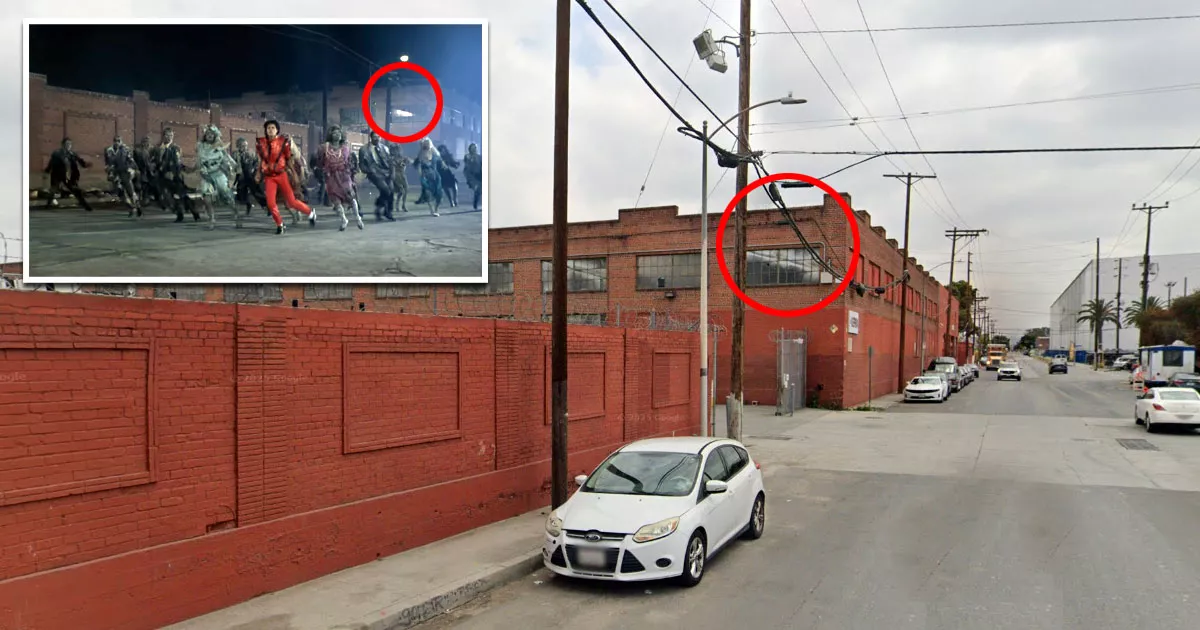
This is the location where the iconic zombie dance scene from Michael Jackson's "Thriller" was filmed.
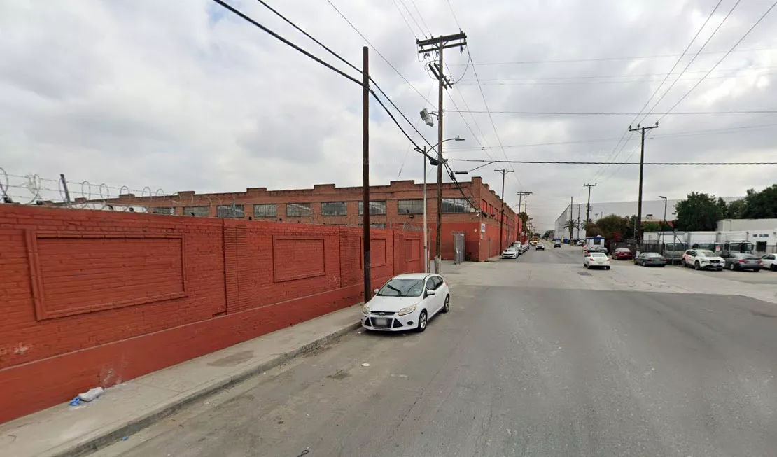
It is situated at 3701 East Union Pacific Avenue in Los Angeles, California.
The music video, which cost $500,000 to make, was shot at this location in October 1983.
It was released two months later on December 2, 1983.
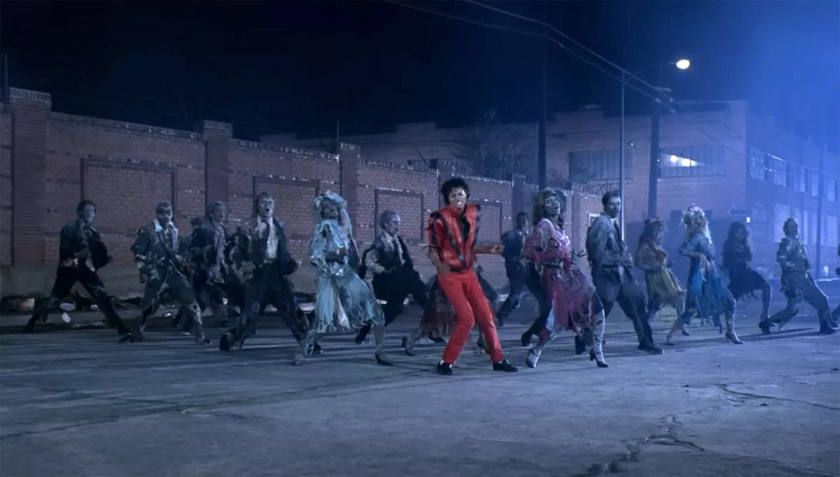
The video references numerous horror films. One of the most memorable scenes involves Jackson dancing with a horde of zombies, a sequence that was inspired by George A. Romero's 1968 film Night of the Living Dead.
The story revolves around Jackson and his date (played by Ola Ray), who are walking down a dark street after leaving a nearby movie theater.
As they are passing a cemetery, zombies rise from their graves and surround them. Jackson subsequently transforms into a zombie and dances with the horde.
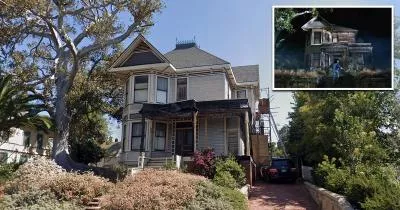
Following the dance, Jackson's date runs into an abandoned house. Although the video makes it seem as though the two locations are nearby, the house in question is actually six miles away, in a neighborhood called Angelino Heights.
The video is credited with transforming music videos into a serious art form. It is also widely regarded as the most famous music video of all time.
In 2009, it became the first music video to be inducted into the US National Film Registry as "culturally, historically, or aesthetically significant."
Address
The address and GPS coordinates for the street are as follows:
Address
3701 Union Pacific Ave, Los Angeles, CA 90023, USA
GPS Coordinates
34.016527, -118.196678
34°00'59.50"N 118°11'48.04"W
Get Directions
Open this location in your preferred maps app:
Area Information
Vernon is an industrial area that lies to the south of downtown Los Angeles.
📍 It is situated near the corner of Union Pacific Avenue and Calzona Street.
Closest Locations
Other locations that are relatively close to this address:
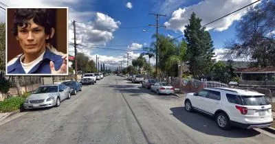
The location where Richard Ramirez was arrested
Roughly one mile away.
Arrest Location in Los Angeles, California
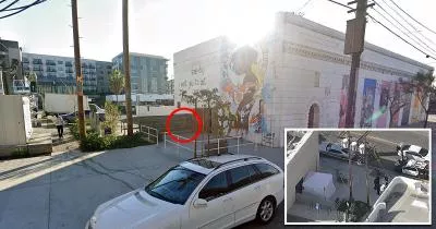
The sidewalk where Mark Diggs was murdered
Roughly 3 miles away.
Crime Location in Los Angeles, California
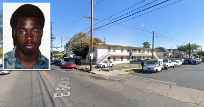
The corner where Crips founder Raymond Washington was killed
Roughly 6 miles away.
Crime Location in Los Angeles, California