Graball Landing: The site where Emmett Till was found
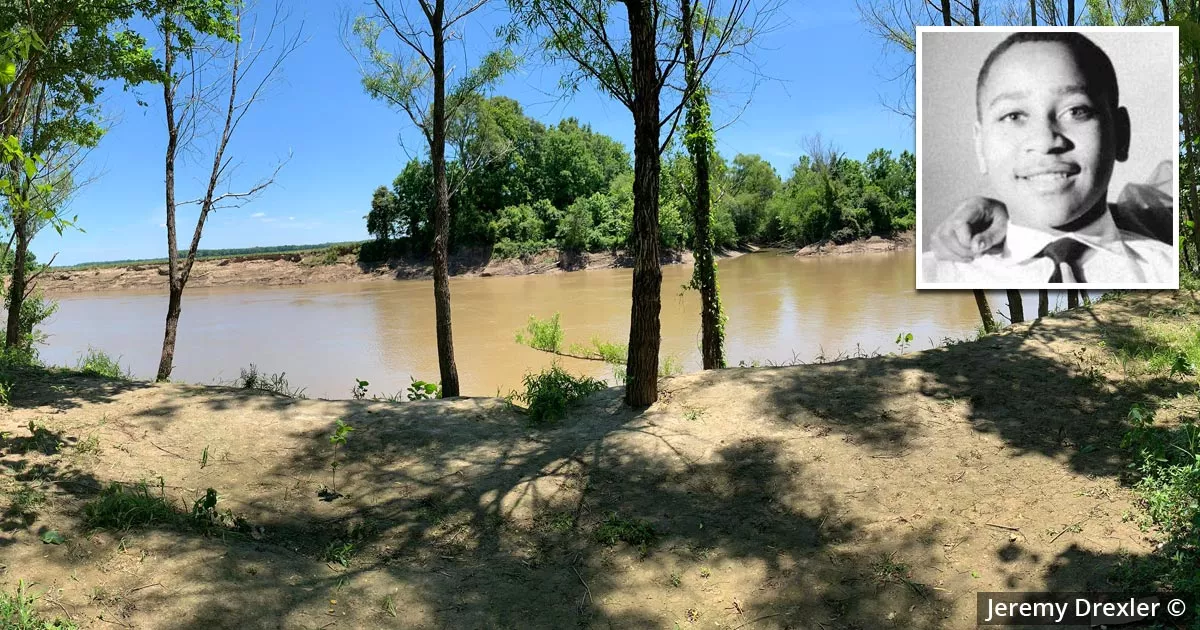
This is the location where Emmett Till is believed to have been found.
It is called Graball Landing, and it is situated near Glendora, Mississippi.
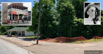
Till was an African American teenager who was abducted and lynched in August 1955 for allegedly wolf-whistling at the wife of a white grocery store owner.

Following the murder, his killers attached a heavy cotton gin fan to his neck and threw his body into the Tallahatchie River.
Three days later, two boys were fishing several miles downstream when they noticed the teenager's remains floating in the river.

Till's murder was a catalyst for the civil rights movement, which campaigned to abolish racial discrimination in the United States.
The manner of his death and the subsequent acquittal of his killers highlighted the systemic racism prevalent in Mississippi and the Deep South.
Location debate
There is debate over whether this was the exact spot where Till's body was discovered.
While Graball Landing is the official memorial site, some historians believe he was found further downstream, at a location called Fish Lake Landing.
To complicate matters further, the FBI concluded that Till's remains were found further east, at a short section of the river that veers south into Leflore County.

Given the passage of time, it is unlikely that a consensus will ever be reached.
Despite the debate, Graball Landing has become the designated memorial site for the recovery of Till's remains.
History
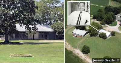
The history of this location dates back to 1840, when slaves were forced to clear the vegetation from the northern banks of the Tallahatchie River to make way for a steamboat landing.
The landing and its adjoining buildings were later destroyed by a tornado in 1894.
Although the tornado wiped away all traces of the original site, it left a clearing in the thick brush, which provided locals with an access point to the river.
Vandalism
The site is a frequent target of vandalism. Over the years, memorial markers have been repeatedly shot at and thrown into the river.
The vandals were so persistent that the memorial commission started using heavy, one-inch-thick bulletproof materials.

The current sign reads as follows:
"Since the Emmett Till Memorial Commission first commemorated Graball Landing in 2008, it has become a nationally recognized memory site. Signs erected here have been stolen, thrown in the river, replaced, shot, removed, replaced, and shot again. The history of vandalism and activism centered on this site led ETMC founder Jerome Little to observe that Graball Landing was both a beacon of racial progress and a trenchant reminder of the progress yet to be made."
A second marker at the turnoff on Sharkey Road serves as a signpost for the site.

This marker has also been shot at multiple times.
Location
The address and GPS coordinates for the site are as follows:
Address
River Road, Glendora, MS 38928, USA
GPS Coordinates
33.831783, -90.270229
33°49'54.42"N 90°16'12.82"W
Get Directions
Open this location in your preferred maps app:
Area Information
Glendora is a village in Tallahatchie County. It is roughly 100 miles south of Memphis.
📍 The site lies to the east of Glendora. It is accessible via Sharkey Road, which is on the northern outskirts of the village.
Closest Locations
Other locations that are relatively close to this address:
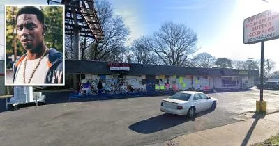
The store where rapper Young Dolph was shot dead
Roughly 109 miles away.
Death Location in Memphis, Tennessee
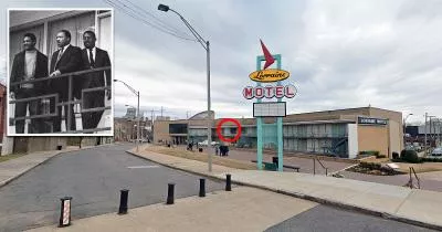
The motel where Martin Luther King was assassinated
Roughly 113 miles away.
Assassination Site in Memphis, Tennessee
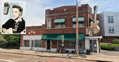
The studio where Elvis Presley recorded his first record
Roughly 114 miles away.
Place of Interest in Memphis, Tennessee