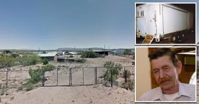
The location where Pat Garrett was killed
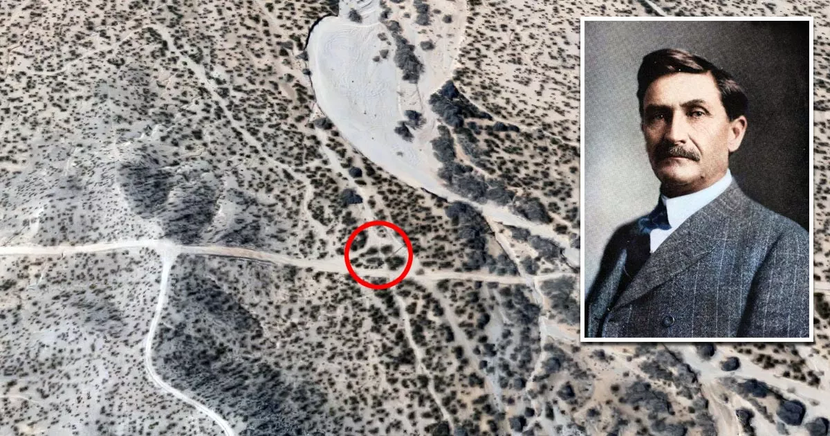
This is the location where Pat Garrett was killed.
It is situated in a desert area on the northeastern outskirts of Las Cruces, New Mexico.
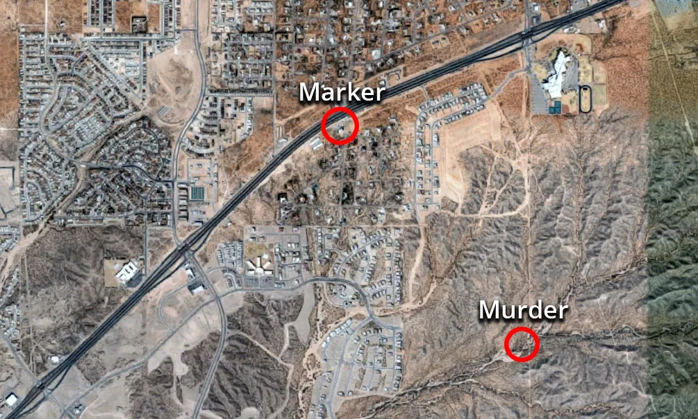
Although a historical marker for Garrett's murder exists at the corner of Bataan Memorial East and Jornada Road (Route 70), that is not the site where he was killed. The exact spot is actually 1.2 miles southeast of the marker.
Google Maps shortcut
Garrett was an "Old West" sheriff who shot and killed the infamous outlaw "Billy the Kid" in 1881.
He served as the "collector of customs" in El Paso, Texas, between 1902 and 1906. However, President Theodore Roosevelt dismissed him following a series of controversies, one of which involved him getting into a fistfight with an employee.
After losing his job, Garrett returned to New Mexico, where he had previously worked as a sheriff.
Murder
On February 29, 1908, the former lawman was shot dead over a land dispute. Although a local ranch hand named Jesse Wayne Brazel confessed to pulling the trigger, he was found not guilty after claiming that he had acted in self-defense.
One witness said that the pair were having a heated argument when Garrett reached for the shotgun that he kept underneath his seat. In response, Brazel pulled out his revolver and quickly shot him twice.
Over the years, there have been multiple theories about the circumstances of Garrett's death.
At least five different men have been put forward as suspects. Several authors have also speculated that Garrett may have been the victim of a conspiracy.
Given the passage of time, it is unlikely that we will ever find out what really happened.
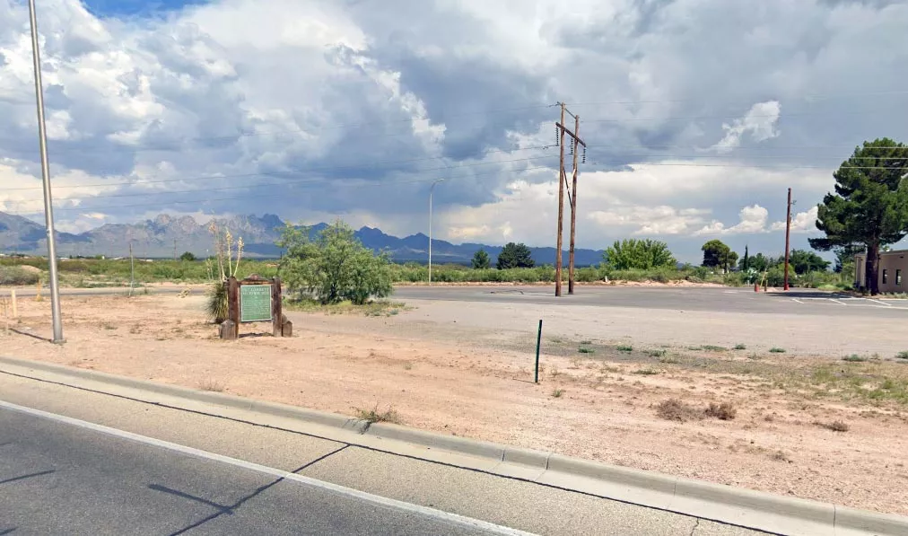
Marker
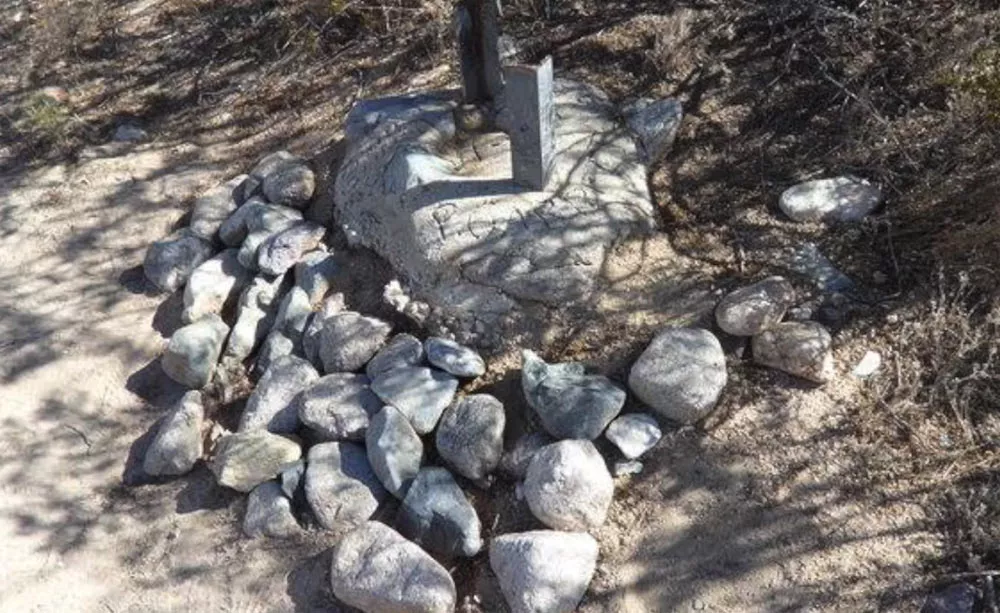
In 1908, two men named William and Emmitt Isaacks placed a stone carved with a cross at the site. Then, in 1965, Hudson Murrell and John Griggs added cement to the marker. They also inscribed the words "P. Garrett" and "Feb 1908."
More recently, a history advocacy organization called the "Friends of Pat Garrett" installed a plaque at the location.
The plaque reads as follows:
"On this site, famed New Mexico lawman Patrick Floyd Garrett met his death on February 29, 1908, while traveling to Las Cruces from his home just east of San Augustin Pass. Garrett is known worldwide for killing Billy the Kid. Garrett was formerly Sheriff of Doña Ana County and Lincoln County. William and Emmitt Isaacks marked this site in 1908 with a stone carved with a cross. The cement was added to the marker on November 6, 1965, by Hudson Murrell and John Griggs."
Location
The address and GPS coordinates for the site are as follows:
Address
Las Cruces, NM 88011, USA
GPS Coordinates
32.366149, -106.717132
32°21'58.14"N 106°43'01.68"W
Get Directions
Open this location in your preferred maps app:
Area Information
Las Cruces is a city in Doña Ana County, which is in the south of New Mexico.
Map Viewer
There is more than one location associated with this entry. To view these places on one map, you can use the following feature:
Closest Locations
Other locations that are relatively close to this address:
The Toy Box Killer's trailer
Roughly 81 miles away.
Serial Killer House in Elephant Butte, New Mexico