Jayne Mansfield's crash site
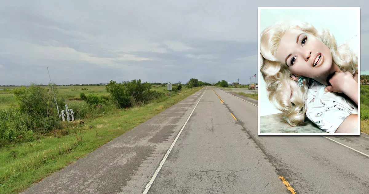
This is the site where actress Jayne Mansfield was killed in a car crash.
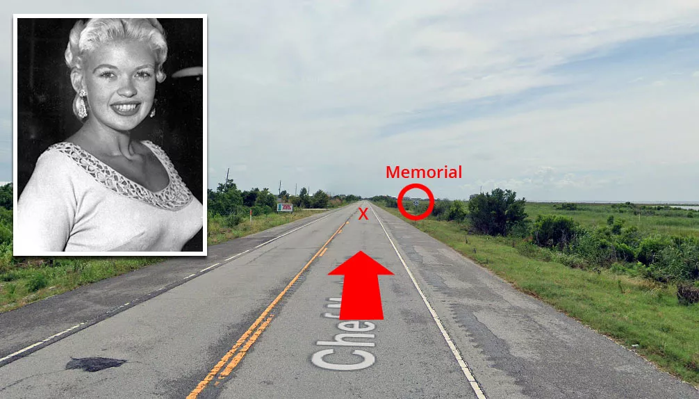
It is situated on the Chef Menteur Highway in New Orleans, Louisiana, just one mile south of the Rigolets Bridge.
Rise to fame
Mansfield was a Playboy Playmate, beauty contestant, and actress who actively courted media attention by appearing in newspaper photographs, wearing revealing outfits, and purposely having wardrobe "malfunctions."
At the height of her fame, she starred in popular movies such as "Will Success Spoil Rock Hunter?" (1957), "The Girl Can't Help It" (1956), and "Too Hot to Handle" (1960). She also performed in nightclubs, acted in Broadway productions, and appeared on television shows.
Mansfield was married three times and had several highly publicized relationships. There were also rumors of her being romantically involved with high-profile men such as John F. Kennedy, Robert F. Kennedy, and billionaire Jorge Guinle.
Throughout her career, she was repeatedly compared to Marilyn Monroe, who was considered Hollywood's reigning "blonde bombshell."
Mansfield struggled with alcoholism after her career declined in the mid-1960s. She and her partner, Sam Brody, allegedly had several drunken brawls during their relationship. There were also reports that Brody was physically abusive toward Mansfield's eldest daughter.
Crash
In the early hours of June 29, 1967, Mansfield left the Gus Stevens Supper Club in Biloxi, Mississippi, in a 1966 Buick Electra.
That night, she was traveling with Brody and her three children. Their driver, Ronnie Harrison, worked for the club, which owned the Buick.
Their intended destination was New Orleans, where Mansfield was scheduled to appear on WDSU's Midday Show the following afternoon.
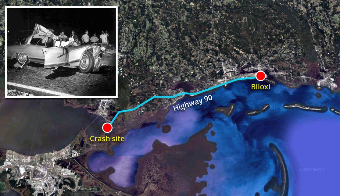
Roughly 90 minutes into their journey, they crossed the Rigolets Bridge, heading south on Highway 90.
Harrison was driving roughly 60-80 mph (95-130 km/h), despite the mist and fog of the marshland, which would have distorted his sense of distance and reduced his visibility.
Unbeknownst to Harrison, a large tractor-trailer (lorry) had slowed down up ahead to accommodate a mosquito fogging truck, which was pumping out a large, thick cloud of insecticide.
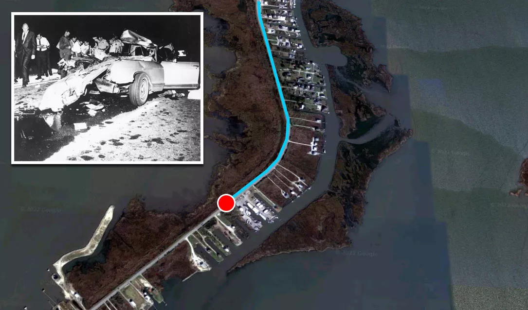
Shortly after the car made its way around a large bend, it slammed into the back of the trailer.
The impact ripped the top of the Buick off, leading to reports they had been traveling in a convertible.
Mansfield, Harrison, and Brody were all killed instantly. The three adults, who were sitting in the front, sustained multiple head traumas and fractures that were incompatible with life.
The car hit the truck with such force that the 34-year-old actress was tossed out of the vehicle. When the authorities arrived, her body was lying on the shoulder of the road.
Miraculously, her three children survived the crash with minor injuries because they were asleep in the back.
Aftermath
Although there were initial reports that Mansfield's head had been decapitated, witness accounts, accident photographs, and her autopsy report confirmed that this was false.
At the time of impact, she was wearing a blonde wig, which flew off and became stuck in the windshield. The sight of this wig in photographs fueled rumors that it was her head.
Following her death, the trucking industry began fitting underride guards on the back of trailers. These guards help to prevent cars from going underneath the trailer during a collision.
To this day, they are often referred to as Mansfield bars.
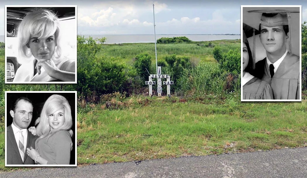
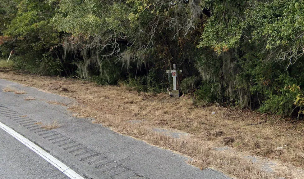
Memorial
A memorial shrine, which features three crosses labeled Jayne, Ron, and Sam, is located at the side of the road where the crash occurred.
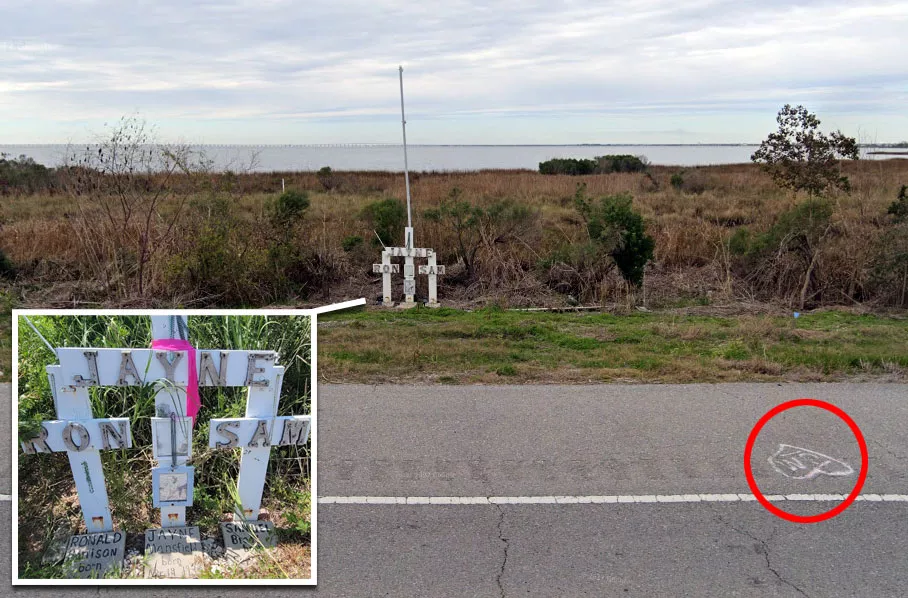
Ron was just 20 years old.
The crosses were placed here in 2019 after a local historian read the police files about the accident and discovered that the previous memorial site was incorrect.
Google Maps shortcut
Originally, the memorial was situated five miles south of the actual site.
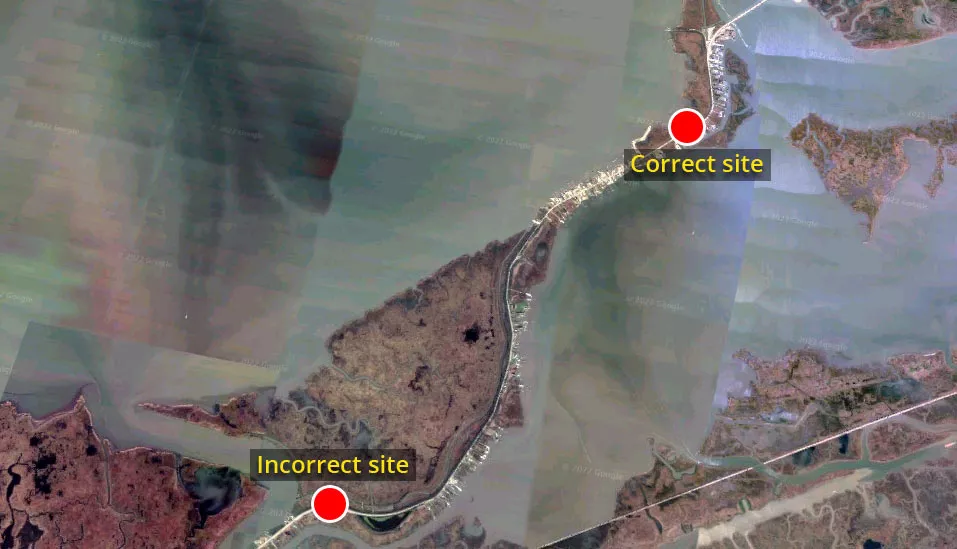
The most likely explanation for this mistake is that someone incorrectly determined that the accident occurred at the most southerly bend instead of the one close to the Rigolets Bridge.
Location
The address and GPS coordinates for the site are as follows:
- This Location
- View Photo
Address
Chef Menteur Highway (Highway 90), New Orleans, LA 70129, USA
GPS Coordinates
30.149657, -89.741679
30°08'58.77"N 89°44'30.04"W
Get Directions
Open this location in your preferred maps app:
Area Information
📍 The site is situated one mile south of the Rigolets Bridge. It is close to Lake Saint Catherine.
Categories
CelebritiesClosest Locations
Other locations that are relatively close to this address:
Crime Location · New Orleans, Louisiana
The street where rapper VL Mike was shot dead
Roughly 27 miles away
Crime Location · New Orleans, Louisiana
The house where Helen Hill was murdered
Roughly 28 miles away