Proctor's Ledge
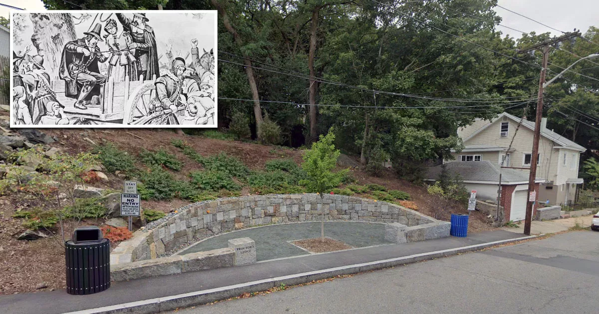
This is the location where 19 innocent people were hanged during the Salem witch trials.
It is called Proctor's Ledge, and it is situated on Pope Street in Salem, Massachusetts.
The Salem witch trials took place between February 1692 and May 1693. During this time, 30 people were found guilty of witchcraft.
Nineteen of the convicted (fourteen women and five men) were executed by hanging at the site on four separate dates in 1692.
For many years, it was believed that the victims were hanged at the summit of Gallows Hill. However, the location was not memorialized, as the residents of Salem viewed the executions as a shameful event that should be confined to the past.
In 1921, a local historian named Sidney Perley concluded that the executions had occurred near the base of the hill, at a site known as Proctor's Ledge.
The City of Salem purchased part of the land in 1936, calling it "Witch Memorial Land."
No memorial was built, however, as there was confusion about the exact location. Planning such a development was also challenging, as it was a small, residential area with limited parking.
In 2010, a team of researchers on the Gallows Hill Project began using Geographic Information Systems (GIS) to compare 1,692 eyewitness accounts against historical maps.
They specifically focused on accounts from people who could see the hangings from their homes.
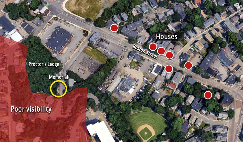
In January 2016, the team confirmed that Proctor's Ledge was the exact execution spot.
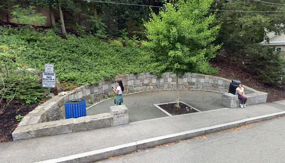
The city built a memorial at the site for the 325th anniversary of the trials.
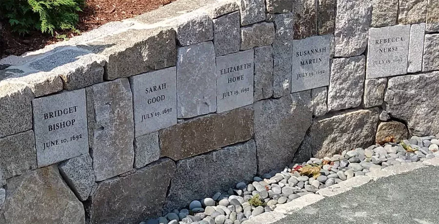
It was designed by landscape architect Martha Lyon and dedicated on July 19, 2017. The memorial features a semicircular wall that has stones engraved with the names of the victims.
Location
The address and GPS coordinates for the site are as follows:
Address
Pope Street, Salem, MA 01970, USA
GPS Coordinates
42.517618, -70.908980
42°31'03.42"N 70°54'32.33"W
Get Directions
Open this location in your preferred maps app:
Area Information
Salem lies to the northeast of Boston.
📍 It is situated on Pope Street, which runs between Proctor Street and Boston Street. Note that there is no parking in the immediate area.
Categories
Historic sitesClosest Locations
Other locations that are relatively close to this address:
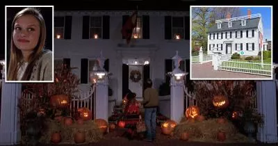
Filming Location · Salem, Massachusetts
Allison's house from Hocus Pocus (1993)
Less than a mile away
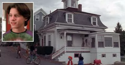
Filming Location · Salem, Massachusetts
Max Dennison's house from Hocus Pocus (1993)
Roughly one mile away
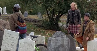
Filming Location · Marblehead, Massachusetts
The cemetery from Hocus Pocus (1993)
Roughly 4 miles away
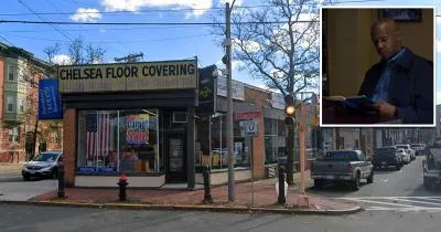
Filming Location · Chelsea, Massachusetts
The Bridge Diner from The Equalizer (2014)
Roughly 13 miles away
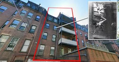
Photo Location · Boston, Massachusetts
The location where the famous "Fire Escape Collapse" photograph was taken
Roughly 18 miles away