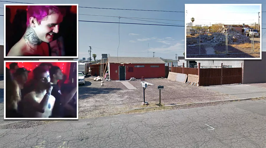
The location where Lil Peep was found dead
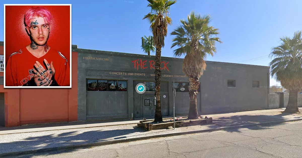
This is the location where rapper Lil Peep was found dead.
It is situated at 136 North Park Avenue in Tucson, Arizona.
On the night of November 15, 2017, the "emo rapper," whose real name was Gustav Elijah Åhr, was discovered in an unresponsive state on his tour bus.
At the time, the bus was parked outside The Rock bar in Tucson, Arizona, where the 21-year-old was scheduled to perform.
That evening, the rapper fell asleep after taking Xanax pills and an opioid painkiller called fentanyl.
In the hours before his overdose, Åhr uploaded Snapchat videos of himself taking pills. Members of his entourage also posted footage of him "sleeping."
In one video, his friend Bexey joked that Lil Peep was "working out" before panning the camera and showing him passed out on the sofa.
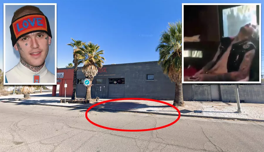
At the time, Bexey did not realize that he had overdosed.
Following his death, rumors circulated that the 21-year-old had unknowingly taken Xanax pills that were laced with fentanyl. However, these claims have never been proven.
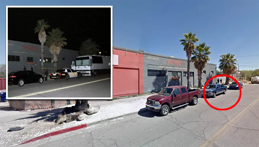
His management team said that they checked on him three times. The first two times, they could see that he was still breathing, but they were unable to wake him up.
During the third check, they realized he had stopped breathing and commenced CPR.
The paramedics who arrived were unable to revive the rapper, and he was later pronounced dead at the scene.
One month later, an autopsy report confirmed that he had died from an accidental overdose.
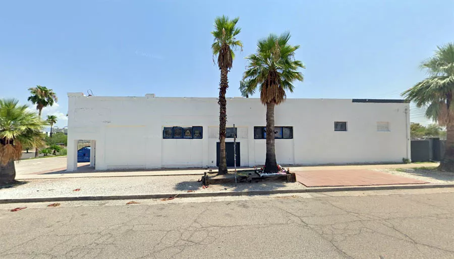
Gary's Place
Coincidentally, Lil Peep's music career had begun in the very same town.
On February 13, 2016, he had his first live performance at a venue called Gary's Place, which was just 2.5 miles away from The Rock.
Google Maps shortcut
That night, he performed as part of a rap group called Schemaposse.
In a tragic twist of fate, Åhr's career ended in the same town where it had begun.
Address
The address and GPS coordinates for the bar are as follows:
Address
136 North Park Avenue, Tucson, AZ 85719, USA
GPS Coordinates
32.223478, -110.956351
32°13'24.52"N 110°57'22.86"W
Get Directions
Open this location in your preferred maps app:
Area Information
📍 The venue is 0.1 miles north of the intersection between East Broadway Boulevard and North Park Avenue.
Map Viewer
There is more than one location associated with this entry. To view these places on one map, you can use the following feature:
Closest Locations
Other locations that are relatively close to this address:
Place of Interest · Scottsdale, Arizona
The restaurant where Shanann Watts had her last meal
Roughly 131 miles away.