Map: Lynyrd Skynyrd's crash site
P P Wilson Road, Gillsburg, MS 39652
The site and its related locations are marked below.
GPS Coordinates
31.071938, -90.599182
31°04'18.98"N 90°35'57.06"W
Get Directions
Open this location in your preferred maps app:
Main Article
The map above belongs to the following article:
Crash Site Location · Gillsburg, Mississippi
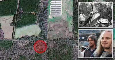
Lynyrd Skynyrd's crash site
On October 20, 1977, Lynyrd Skynyrd's plane crashed into this wooded area near Gillsburg, Mississippi.
Two members of the band were killed in the accident.
Related Locations
The following locations are related to the site. Please note that the descriptions for these images may lack context if you have not read the main article.
Lynyrd Skynyrd memorial
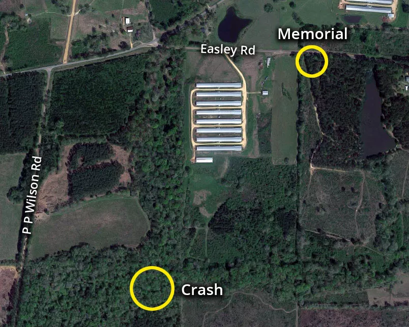
The Lynyrd Skynyrd memorial is situated at 7364 Easley Road, which is roughly 2,700 feet northeast of the crash site.
The aircraft crashed in a swampy, wooded area that sits on private land.
It is not accessible to the public.
The coordinates for the memorial site are available below.
Follow
Follow us on social media: