Map: The house where Pop Smoke was murdered
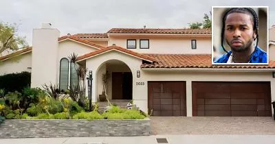
2033 Hercules Drive, Los Angeles, CA 90046
The house is marked below.
GPS Coordinates
34.106502, -118.362737
34°06'23.41"N 118°21'45.85"W
Get Directions
Open this location in your preferred maps app:
Main Article
The map above belongs to the following article:
The house where Pop Smoke was murdered
Death House in Los Angeles, California
In February 2020, home invaders fatally shot rapper Pop Smoke at this house in the Hollywood Hills area of Los Angeles, California.
Follow
Follow us on social media: