Map: The Texas Killing Fields
3535 Calder Drive, League City, TX 77573
The site and its related locations are marked below.
GPS Coordinates
29.465336, -95.111347
29°27'55.21"N 95°06'40.85"W
Get Directions
Open this location in your preferred maps app:
Main Article
The map above belongs to the following article:
Crime Location · League City, Texas
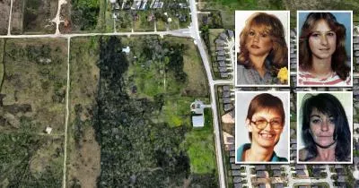
The Texas Killing Fields
Between 1983 and 1991, an unidentified serial killer dumped the bodies of four women in this oil field in League City, Texas.
The area in question has been nicknamed "the Texas Killing Fields."
Related Locations
The following locations are related to the site. Please note that the descriptions for these images may lack context if you have not read the main article.
Main entrance
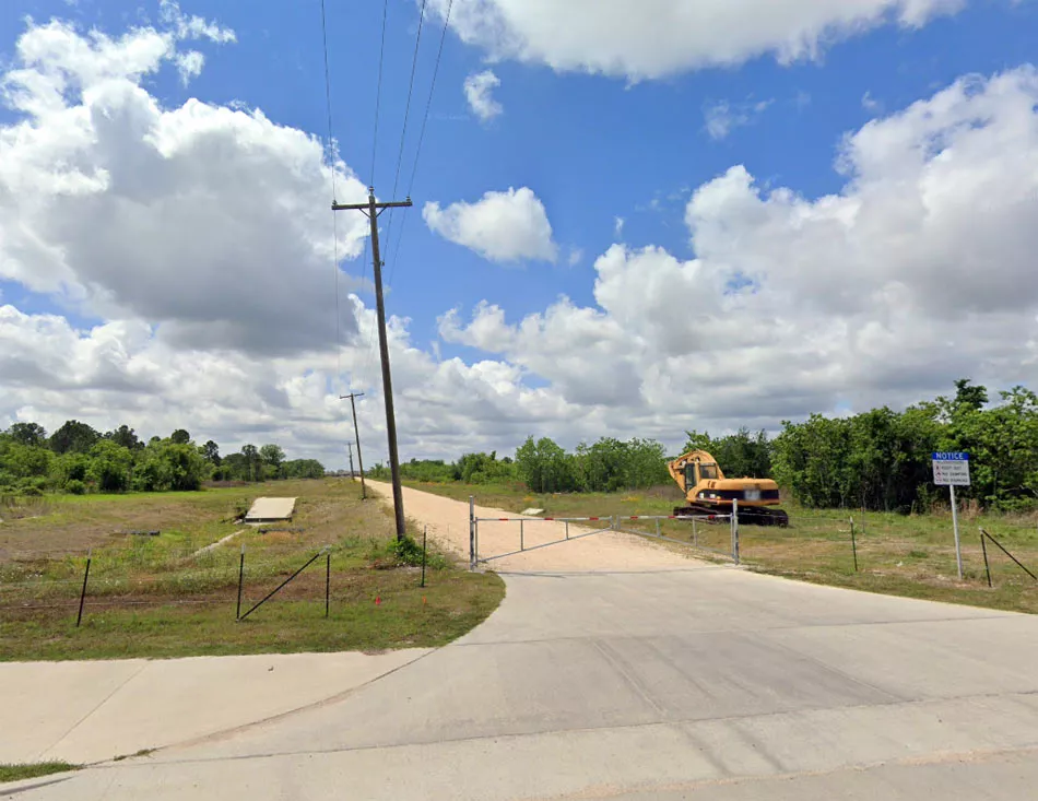
This Google Street View image of the main entrance on Ervin Street was captured in April 2022.
Dirt road

It can also be accessed by a small dirt road, which lies 285 yards (260 meters) west of the main entrance. Credit: Google Maps.
Store (approximate)
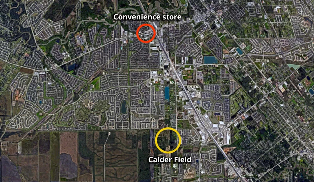
The first two victims were seemingly picked up (or abducted) near a convenience store on the corner of West Main Street and Hobbs Road. The two locations are just three miles apart.
Calder Road entrance (Donna Prudhomme)

Prudhomme disappeared six years after Cook was murdered. She was also found further south than the rest of the victims. In Prudhomme's case, it appears as though the killer used one of these entrances on Calder Road. The entrance on the left runs beside a small stream. Tire marks on the northern bank suggest that it can be traversed by 4x4 trucks and other off-road vehicles.
Memorial site

The memorial site is at the back of the Magnolia Creek Baptist Church.
Follow
Follow us on social media: